

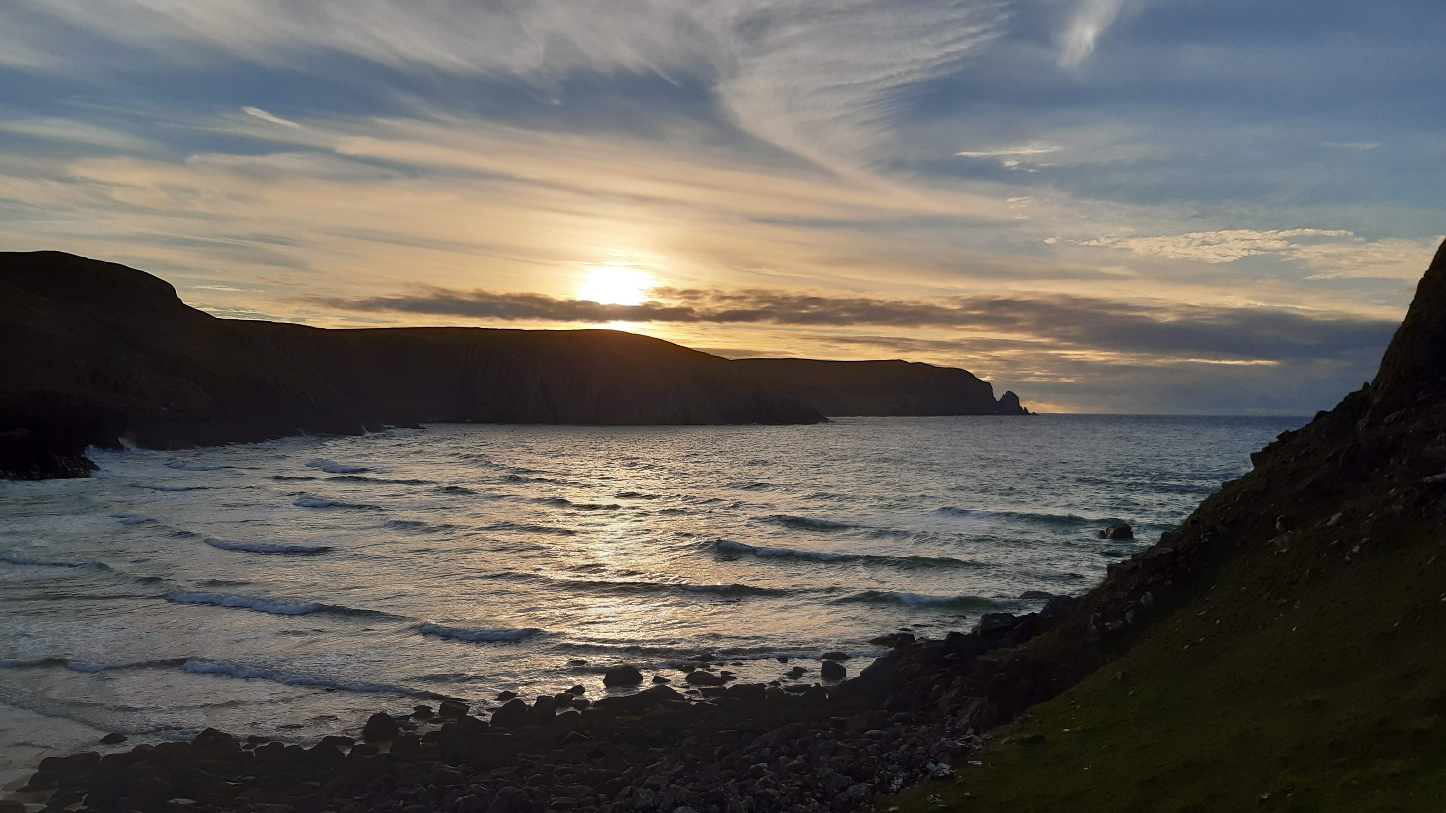
Anyone who knows me knows how special Scotland is to me. It’s one of the last places in the UK where you can get some of those big unobstructed views. Coming from California, this has always been a big part of my life. There’s something in a large landscape devoid of people and buildings that offers me peace. This is why I like to head up to the highlands once a year to take it in for a brief moment. I wasn’t entirely sure if I could get up to Scotland before the weather turned since traveling restrictions seemed to last for so long in the UK due to COVID. But thankfully, that was not the case.
Cycling UK released the Great North Trail mtb route this summer. A route that travels from the bottom of the Peak District to the top of Scotland with either a Cape Wrath or John O’Groats finish. After some chat on the Bikepacking Scotland forum I was pointed towards the Scottish section of the GNT (Great North Trail) which was created by the Obscuro Mondo Cycle Club in Scotland dubbed the An Turas Mor or ‘Long Journey’ in Gaelic. The ATM guidebook recommended the Cape Wrath finish over JOG, which I easily chose as it seemed like a fitting spot to end a long and remote journey, away from the crowds at John O’Groats.
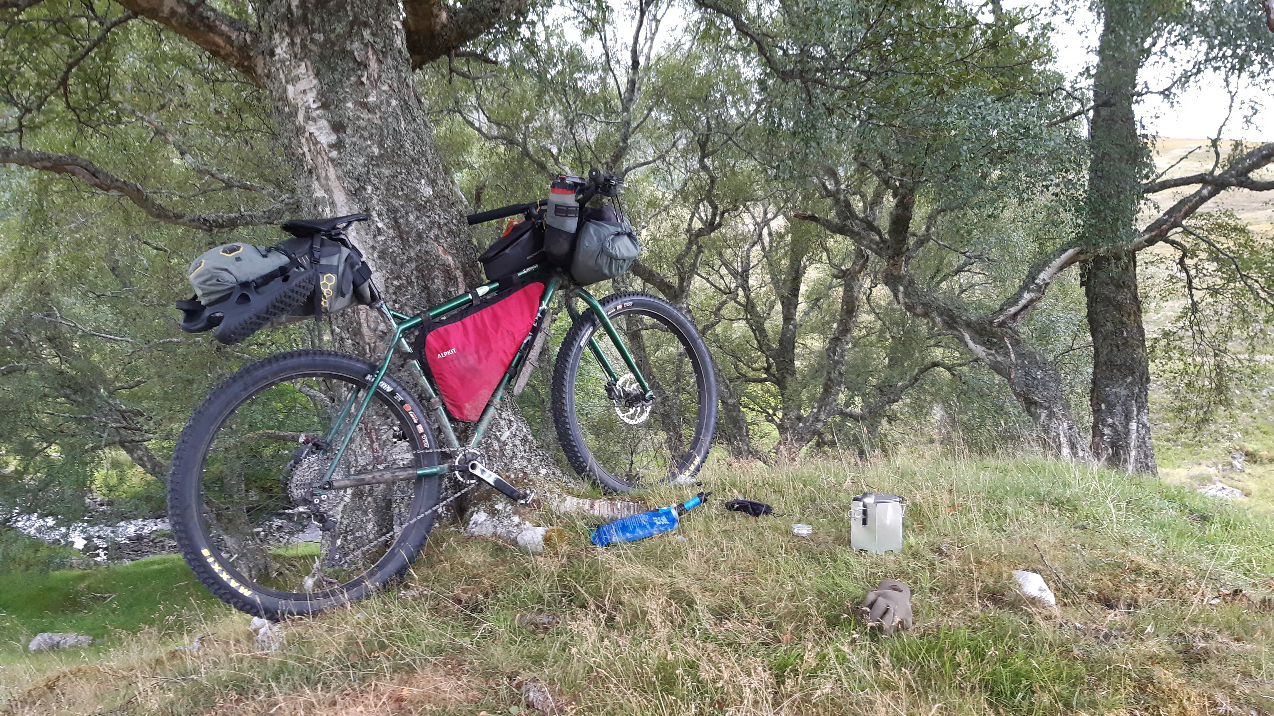
The last two weeks of August were now earmarked as my time off, and I began planning the days up there using the ATM and GNT guide book. I had bought a fresh new pair of wheels and tires while we were in Cornwall over lockdown at Unit Cycles in Threemilestone. They did a great job getting everything together and servicing my bike before I left. All the gear was packed and I was ready to set off.

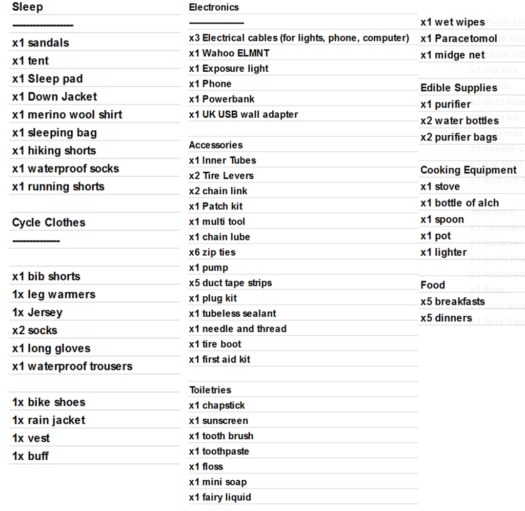
Kit List
Scotland is always hard to judge, especially when you’ll be going remote so I decided to play it safe and bring my tent for the midgies, my 4 season sleeping bag and my thermarest neo air xtherm. I’m glad I brought what I did even though it was heavier and bulkier than a standard summer setup for other parts of the world. It gave me comfort at the end of the day and I didn’t have to wear all my clothes to bed like I had the previous year on the Hebridean way.
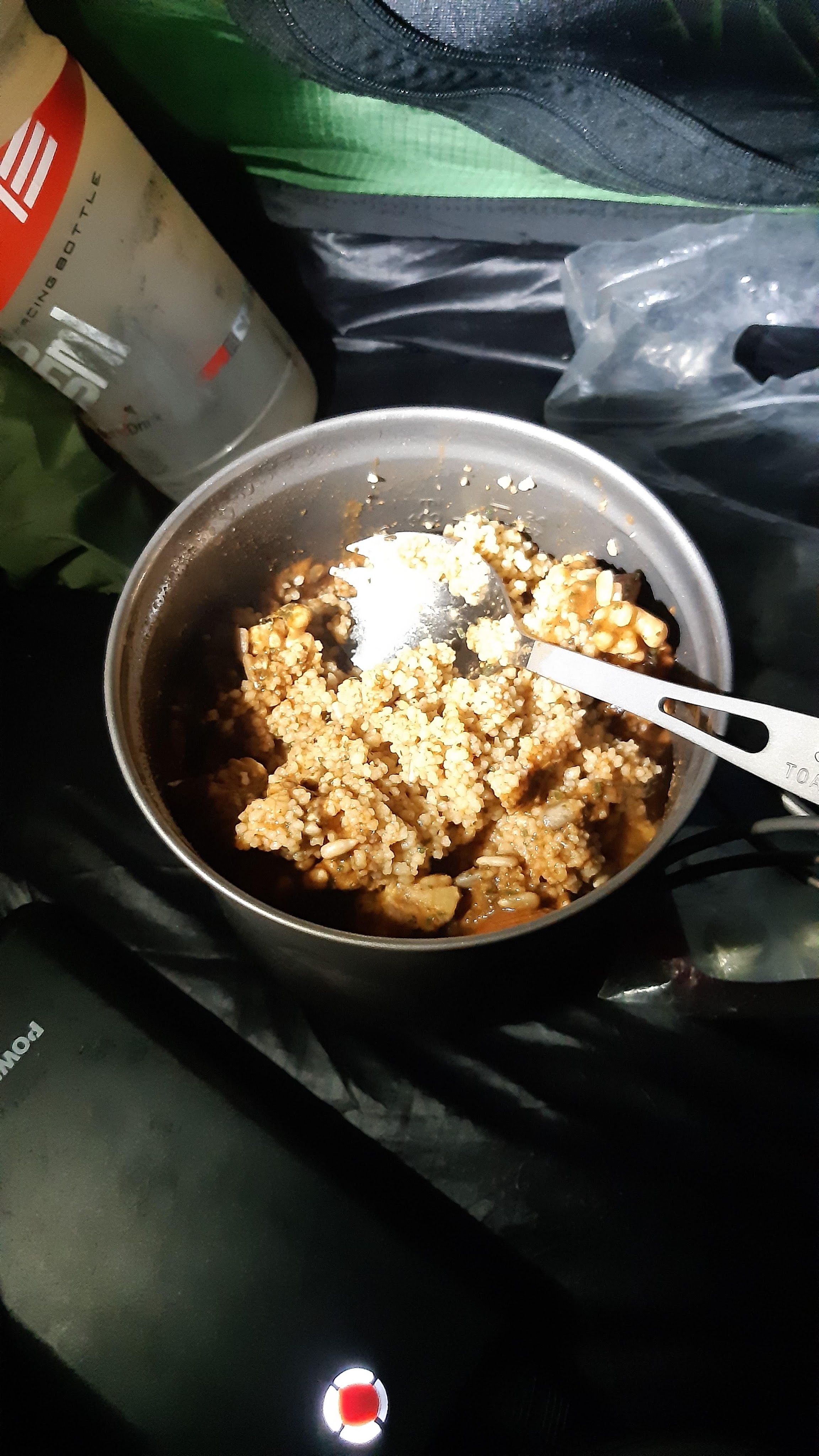
I also knew I needed a way to cook food as I had limited space, so brought a 900ml titanium cook pot, SBP alchohol stove and about 500ml of alchohol which I used almost all of it by the time I finished my 12 day trip. I bought my meals from Tent Meals which I would highly recommend. A UK based company I found on the Bikepacking Scotland FB group. Great whole food meals that are easy to boil and come in 800 calorie pouches which cost around 5 each.
I luckily had no issues besides a spongey hydraulic brake, but I was able to reset the pistons every couple days and that seemed to help before I could get home and give it a proper bleed.
As always, the sawyer mini was perfect, however their cheap plastic bags leave more to be desired, and it began to break about half way through the trip. I’ll be buying a stronger bladder for next time.
My merino wool buff, water proof gloves, water proof trousers and jacket from Showerspass were golden. Also brought x2 pairs of Woolie Boolie socks which were a huge help. When the hygeine starts slipping, the anti stink properties of wool are wonderful, I’d also wrap my buff around one of my dry bags filled with stuff and use it as a pillow to sleep on.
Day 1 Glasgow to Rob Roy Way (30 miles 2000 ft elev)
I arrived into Glasgow Central around 4pm on a Saturday. I knew this wouldn’t give me loads of time to get very far for the day, but was hoping I could at least find a quiet place to set up camp for the evening far enough away from the city. Thankfully Scottish cities seem to be easy to get out of, and I was well on my way. The first bit out of Glasgow hugs the River Clyde, which was probably one of least enjoyable parts of the trip as the path wasn’t in great condition with overgrown nettle bushes, pits of mud, and generally slow progress for a few miles. Thankfully this was not a sign of what was to come!
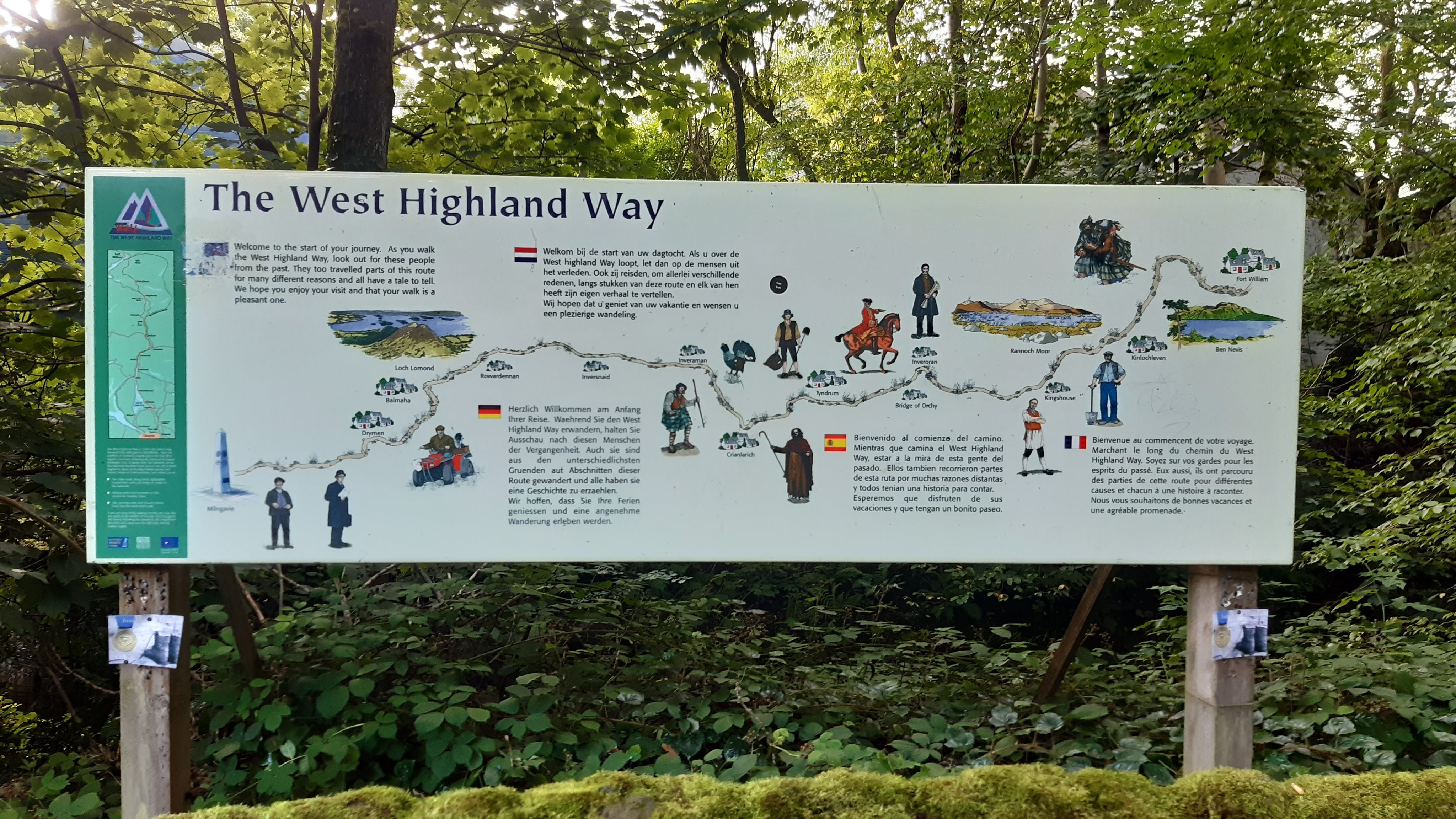
Before I knew it, I was on the famous West Highland Way. As it was past dinner time there were very few people on the trail which is great because it’s the most popular walking path in Scotland – traveling from Milngavie to Fort William. I really enjoyed the 11 or so miles on the WHW and wouldn’t mind cycling the whole thing one day, but as it’s so well used by walkers, I’m sure it wouldn’t be preferable for either me or them.
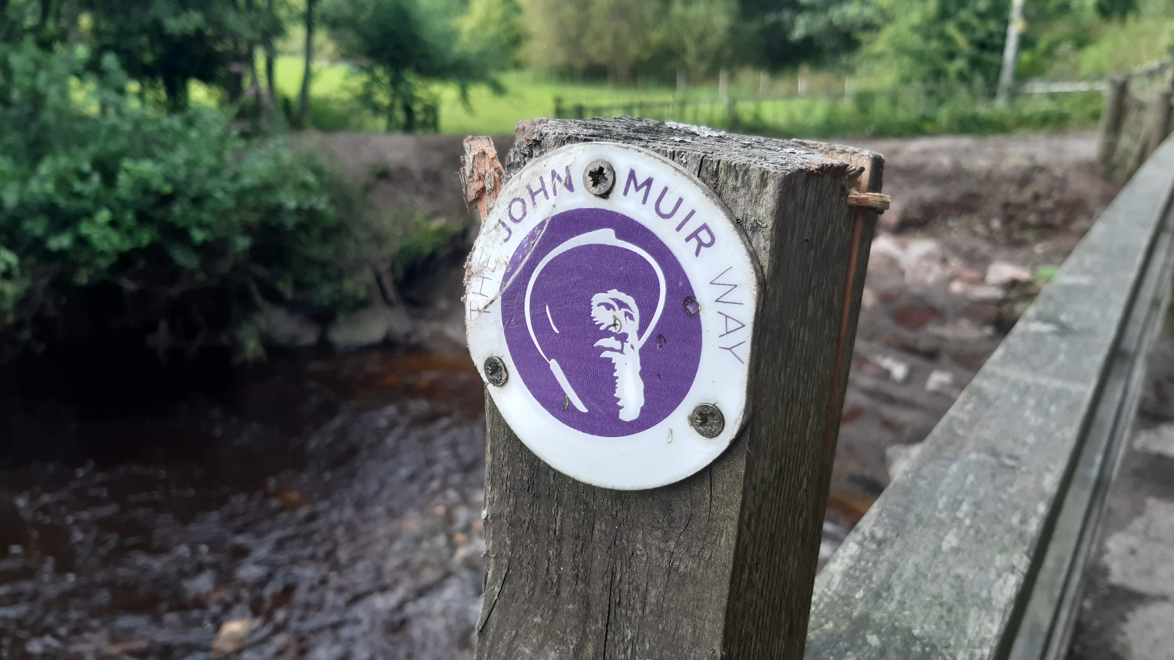
Continuing on I passed markers for the John Muir Way. I didn’t realize John Muir was Scottish until awhile after I moved to the UK. In California there’s the famous John Muir Way and to top it off loads of conservation history on what Muir accomplished back in California. Felt a bit like I was back home when I saw these signs, or at least closer to.


It was quick progress through these sections of trail and tarmac. The first day of around 30 miles or so was very enjoyable. More of this section was on roads then I expected, but naturally you have to link up off road sections to create a monster trail, and they were incredibly quiet throughout the route.
For the evening I set up camp after entering onto the Rob Roy way. Allegedly a path that Rob Roy traveled on during his lifetime and the during Jacobite Uprising. My first mistake and continued mistake on this trip was camping near water sources – which is incredibly relaxing to sleep next to but also prime midge territory during late summer. My mantra eventually became ‘never again in August’ for a trip to Scotland as the midges were incredibly bad this year.

Day 2 Rob Roy Way to Loch Rannoch (76 miles 6000ft elev)
When camping your clock seems to get back into the sleep at night and awake at first light pattern. I particularly enjoy getting into this routine, but anyone that knows me knows I’m not a morning person – and camping in Scotland doesn’t really change that. Luckily, I was on my own and didn’t have anyone to be grumpy with. I awoke most of the trip around 6:30am and had my head down by 9pm or 10pm every night.
This morning I was heading towards Aberfoyle and Callendar before venturing into the proper highlands. I arrived into Aberfoyle early in the morning and as everything was still closed save the local Coop I stopped in and bought a couple Danish pastries before heading off. About 17 years prior I was in Aberfoyle on a trip through Scotland with my mom. I nearly continued on through Aberfoyle to head towards Inchmahome to see the island priory and history we saw together almost two decades ago. Can’t believe how quickly time flies nor did I think when I was that age I’d be coming through this town again but almost a British citizen!
From Aberfoyle was the biggest climb of the trip thus far. Very well maintained forest track through some zip lining areas. Towards the top of the climb were some of the beautiful big views I was looking for on this trip.


As I arrived into Callendar for a breakfast stop I thought it was also best for me to exchange my mosquito net for a midge one as I realised at the worst possible time the night before that midgies are much smaller than mosquitoes. Thankfully there was an outdoor shop that sold one – best 4 pounds I spent on the whole trip. Below is a look at the two nets side by side to show how small those little buggers are. The midge net is green.

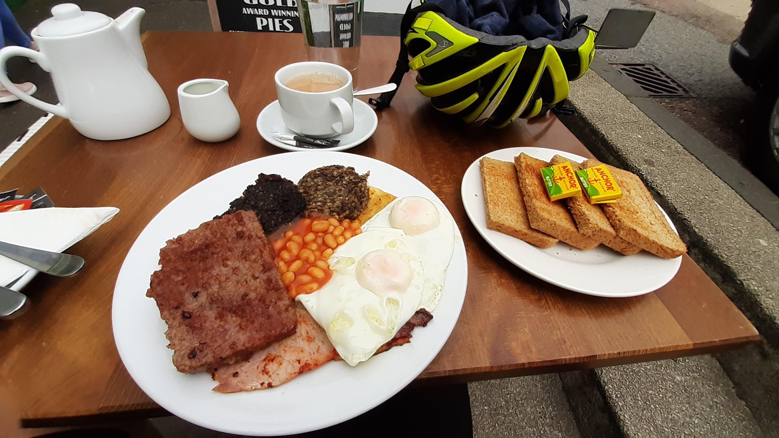
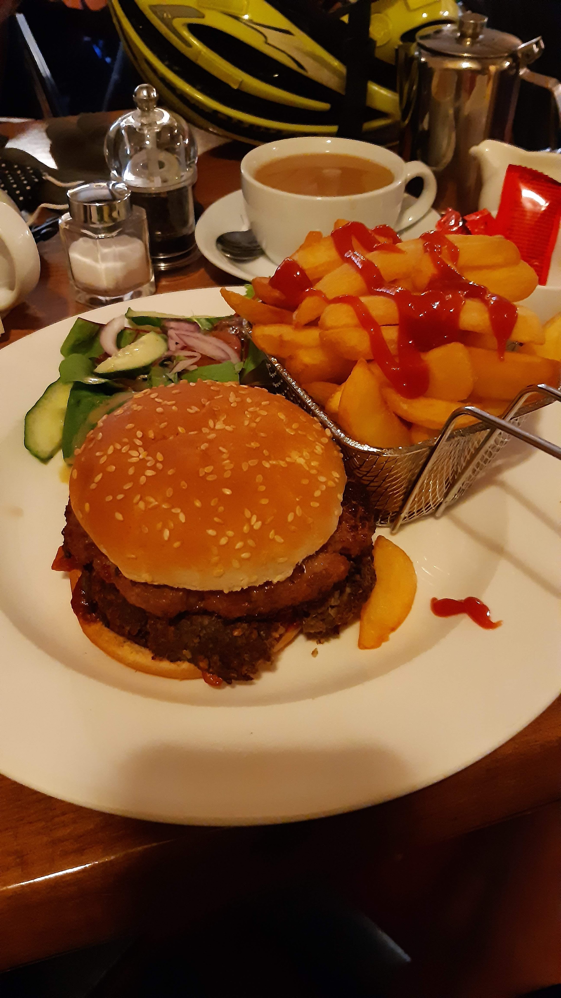
Enjoying a nice (huge) Scottish breakfast at a small greasy spoon cafe, I had the chance to catch up with friends and family back home for a bit before I was into the hills and out of reception again.

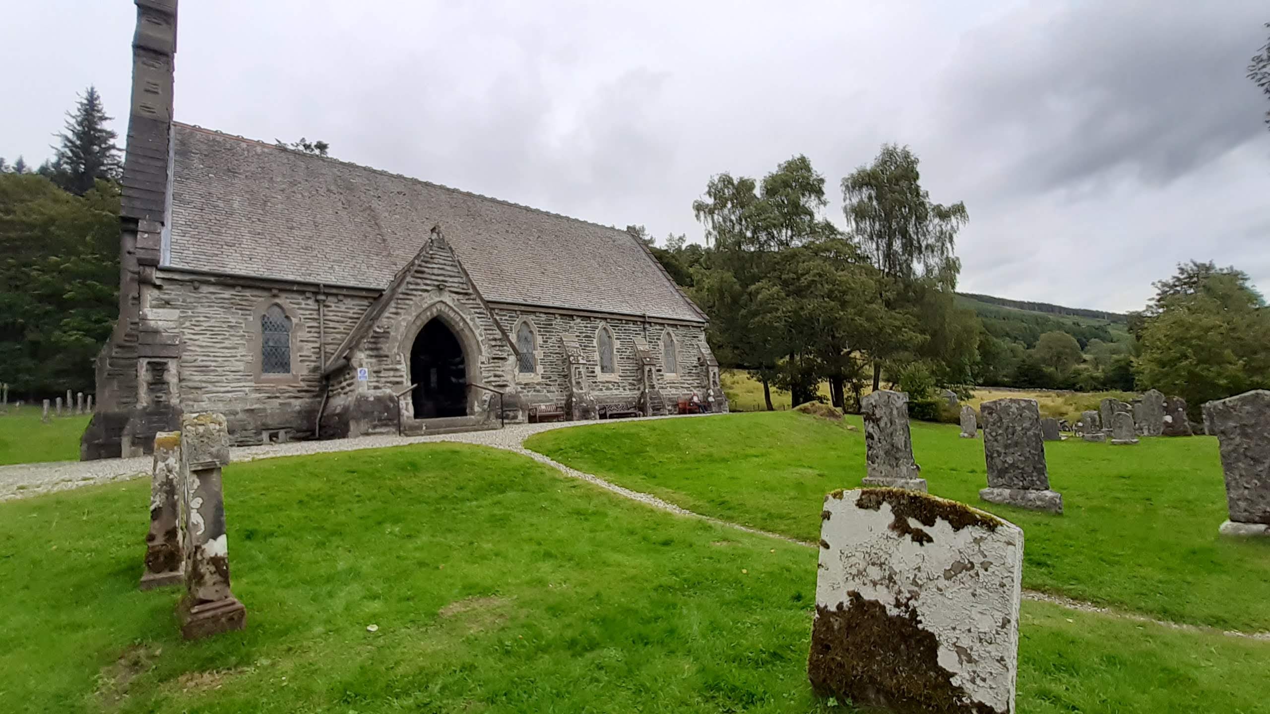
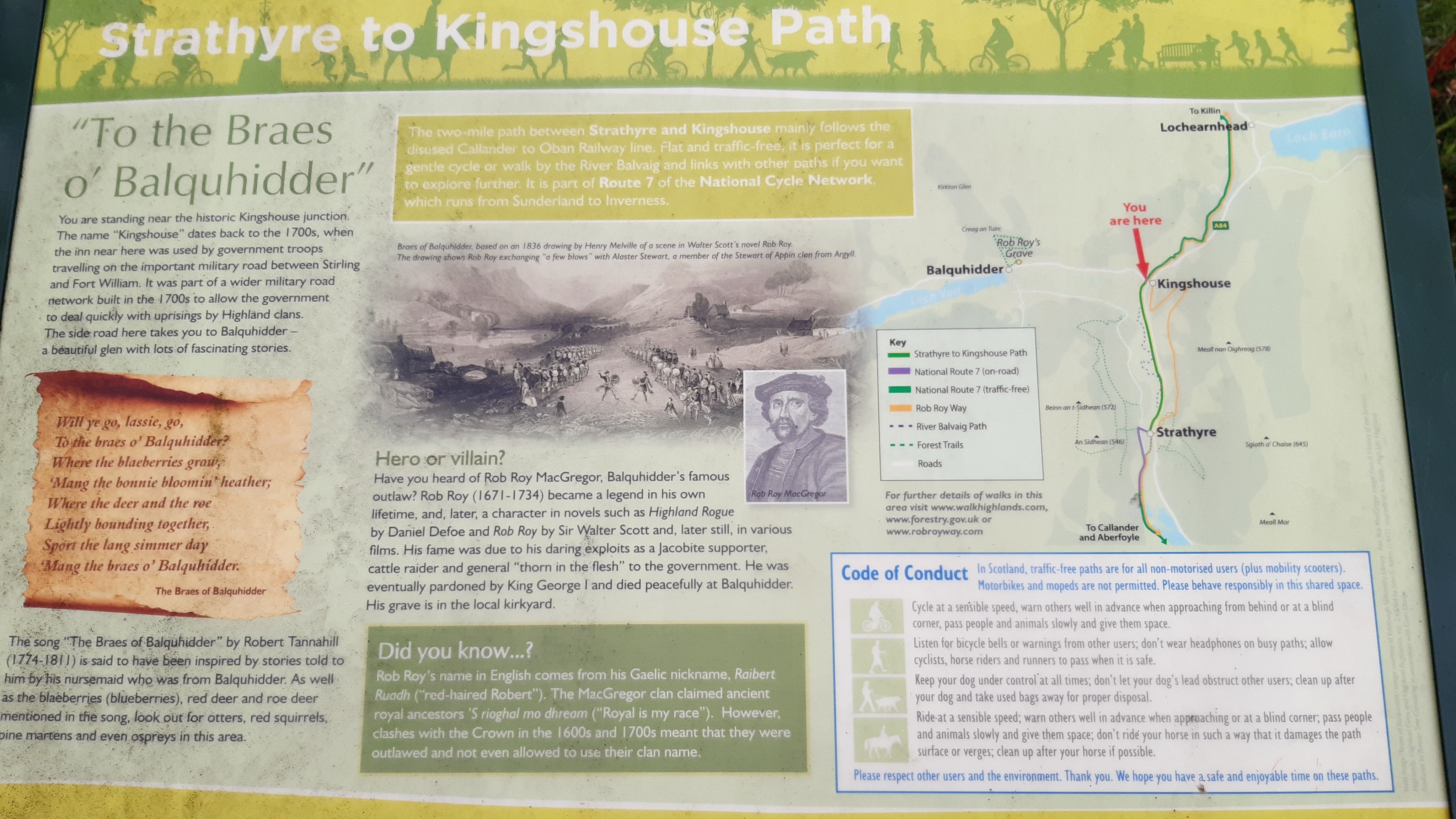
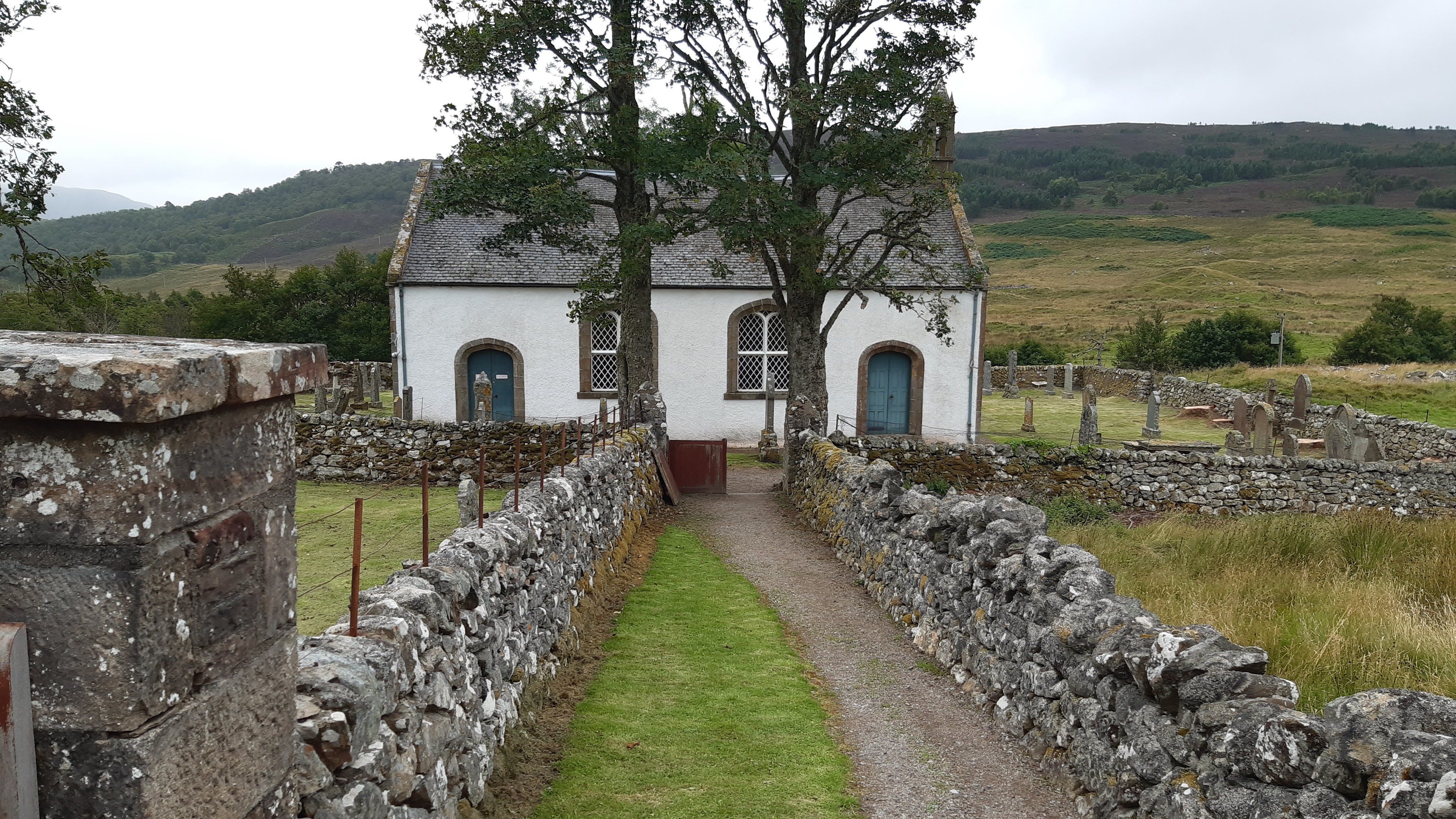
From Callendar I was off and onto some beautiful quiet cycle paths. Lots of families were out enjoying the weather and traffic free trails. Down below in the valley you could hear the whirring of traffic but it was nice to feel far away from it all and safe. Along this cycle route was a placard that had information on Rob Roy and even the location of his grave. Knowing I may never be back on this exact route I decided to take the few mile detour to visit the grave and church where he is buried.


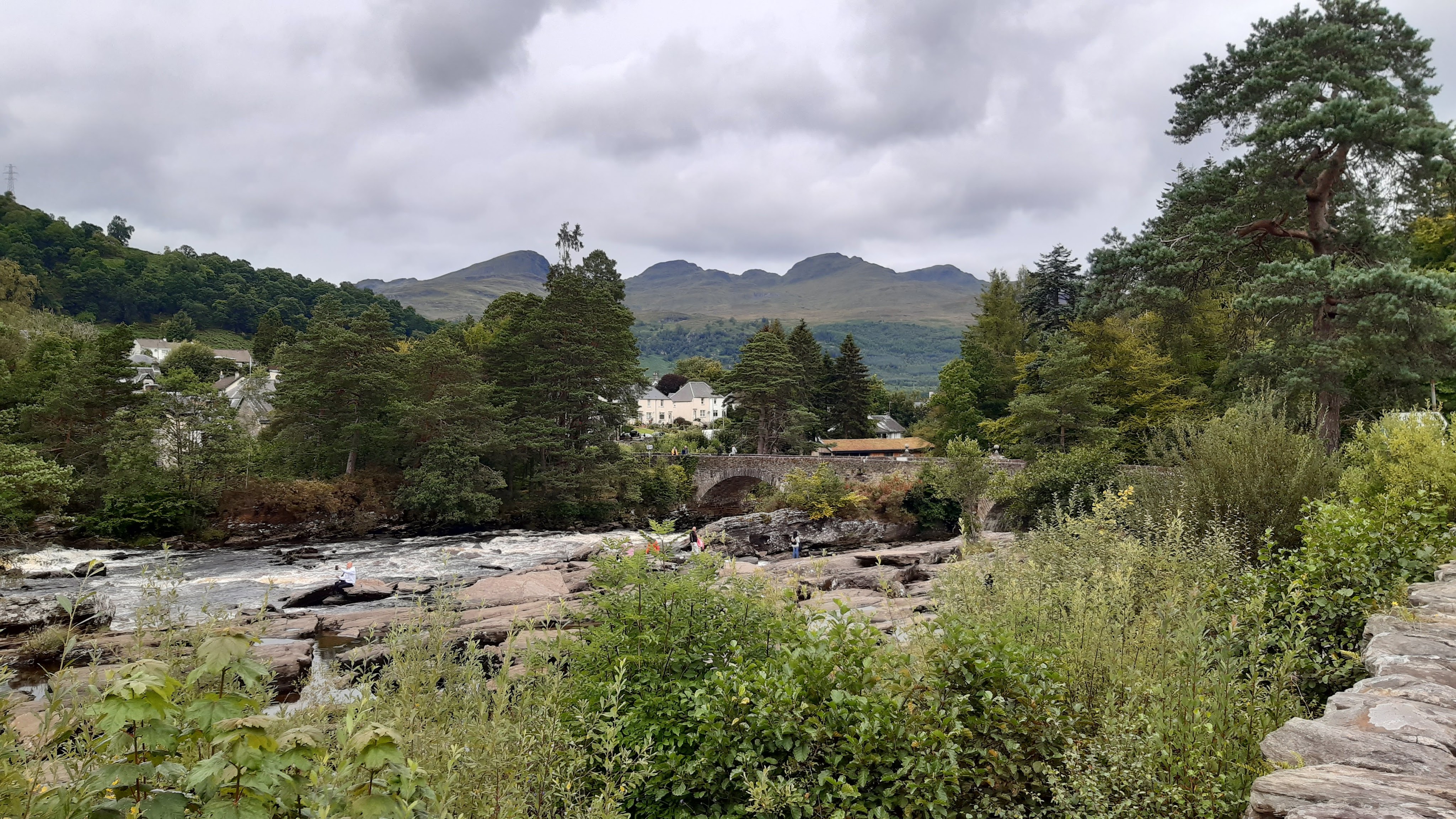
As this was the biggest day of cycling I did on the tour there were more interesting spots to be found. The riding on this section was superb. All quiet NCN routes or well maintained off road tracks. Before I knew it, I had arrived in Killin. Apparently, my mom tells me we visited this place before but I have no recollection of it. It was an interesting town though steeped in Clan warfare and a beautiful bridge with fast flowing river. It was also fairly busy and a reminder that this is the summer of COVID where the beauty spots are jam packed with people. Thankfully this route was remote enough to only get glimpses of these masses of people at certain sections.


From Killin it was off into the hills again. For a longer section of quiet country road past some massive Scottish aqueduct structures. Like many times on this route the road after a few miles would peter out and turn into a gravel track. At the beginning of this gravel track I was feeling a bit tired having not eaten a proper lunch so pulled out my cook set to boil some water for a tea and a couple cookie/cream sandwiches I bought the previous day at a garden center on the way out of Glasgow. Another reminder why I love cycling is the amount of crap I get to ingest and not worry about it tacking onto my gut. This was actually much needed as the climb after this break would be difficult.
After 5 months of lockdown in Cornwall I figured I’d be in great shape for Scottish mountains as Cornwall is absolute pain whichever way you turn as it’s loads of short steep (up and down) hills. I was right, but I forgot how long off road long climbs could take. Also the fact that off road climbs are generally more pitchy than their paved counterparts.
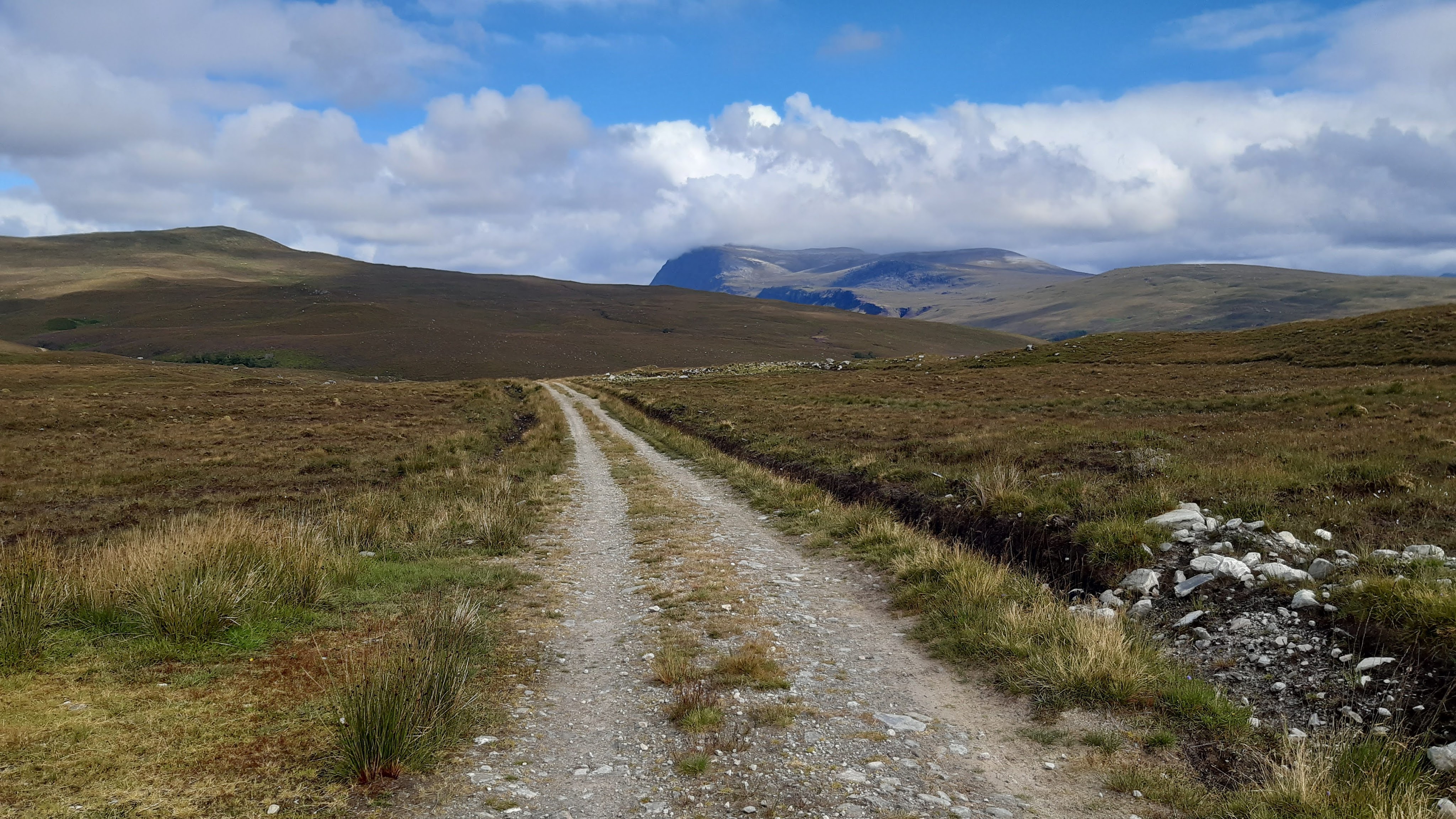
Thankfully this climb I did not have to push, but it was a real lung buster getting to the top, but boy was it worth it. Really started to feel like you were alone out there at the top of this one. A big hill top valley lay ahead of me as I pedaled along past countless sheep.


On the descent I would head into Glen Lyon. One of my favorite evening activities was reading the An Turas Mor guidebook on the route which filled you in on historical tidbits of the area. I love learning about this wonderful country I live in and the sheer scale of it’s history.
Sir Walter Scott said of Glen Lyon that it is the ‘Longest, loneliest, and loveliest of the Glens.’ You were certainly out on your own in this Glen. Sure there were a few houses here and there but it was mostly empty. It was so empty that even an Amazon delivery driver was asking me for directions through the Glen as he hadn’t had phone service for miles.
A few miles later of gentle downhill through Glen Lyon was time for another climb. It was starting to get late by this point. Somewhere around dinner time 5/6pm when I began this next section. Before the climb though was a quaint little gatehouse which apparently is open for tea at some points, but wasn’t as I went past.


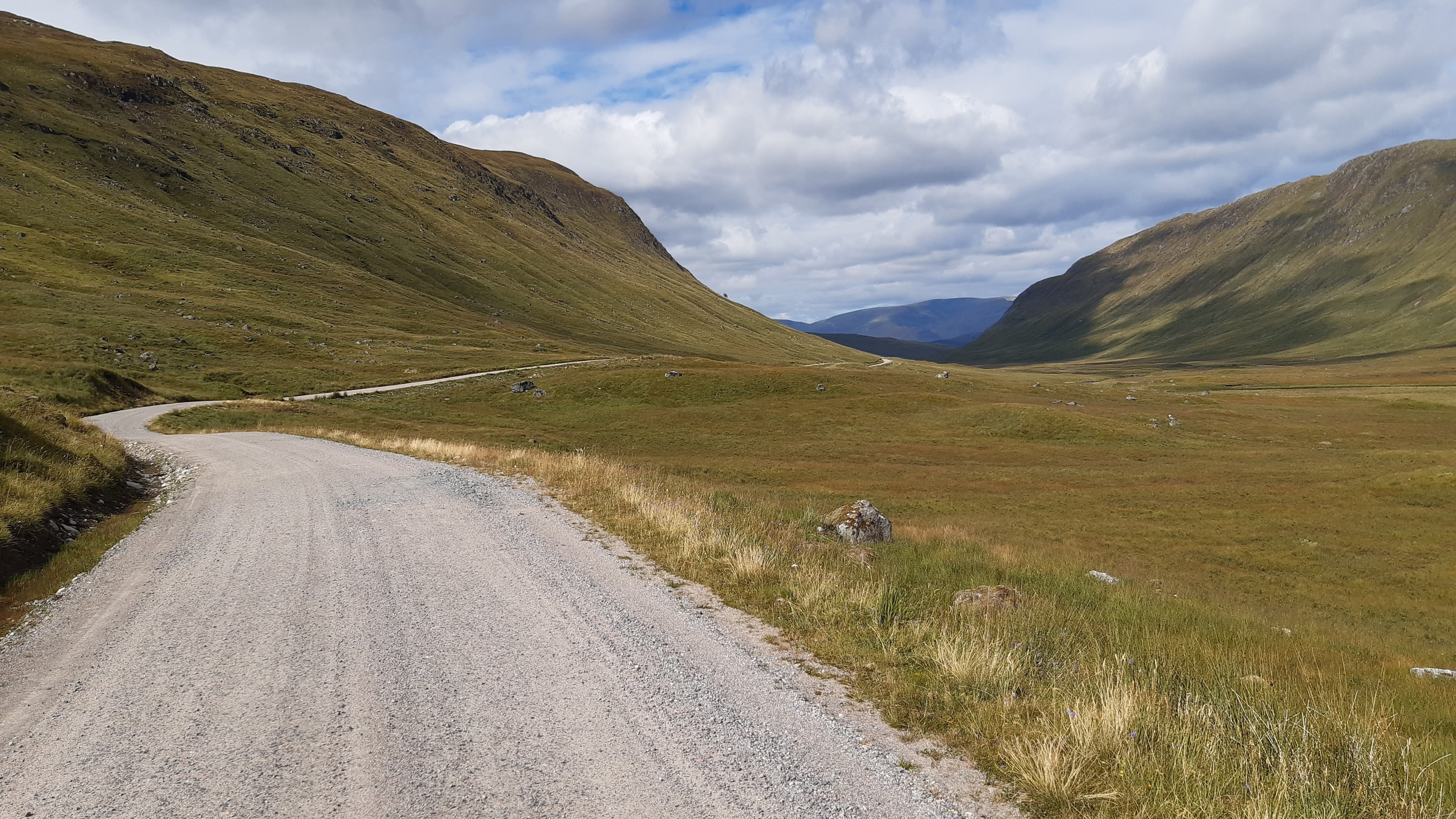
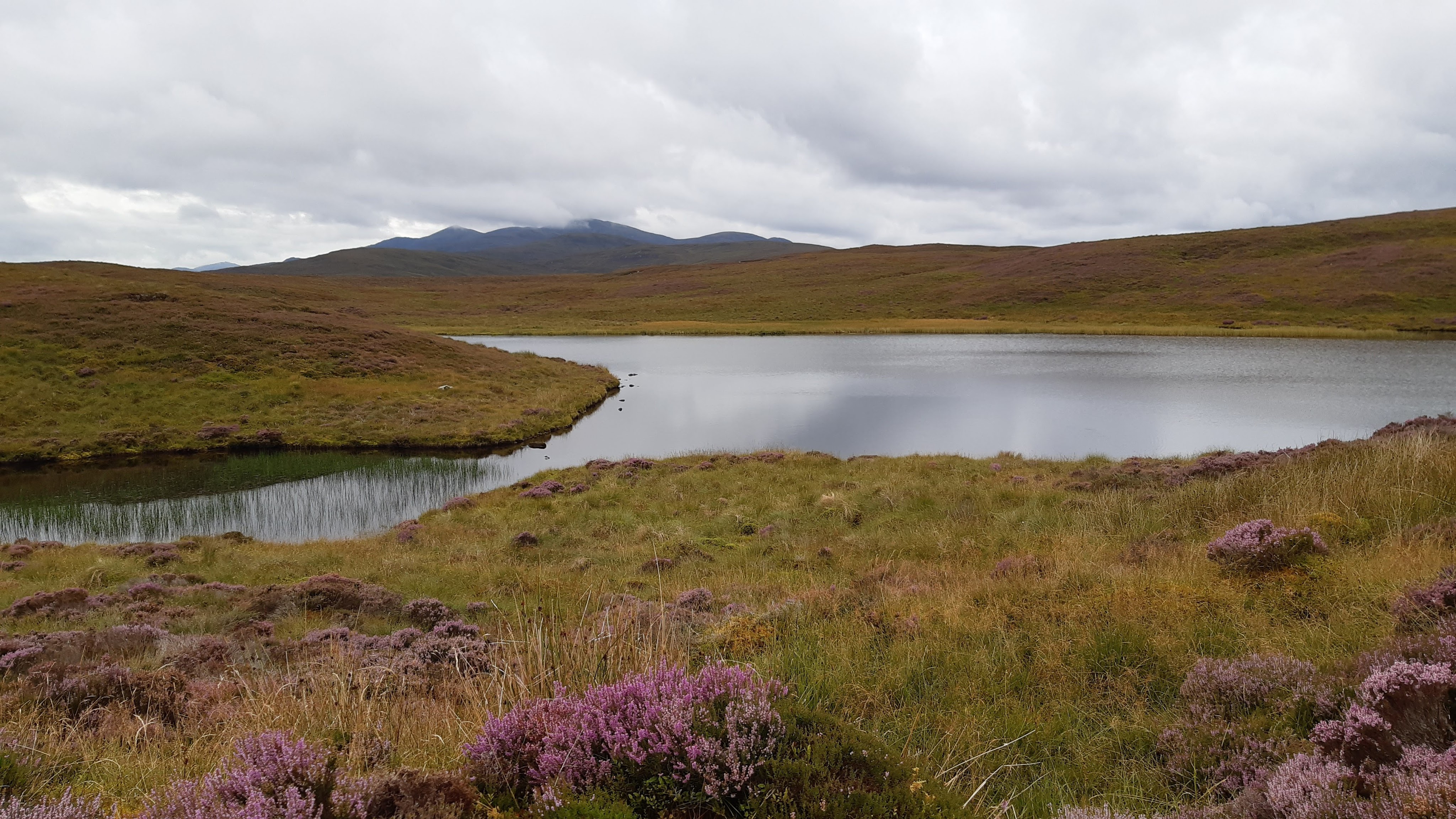
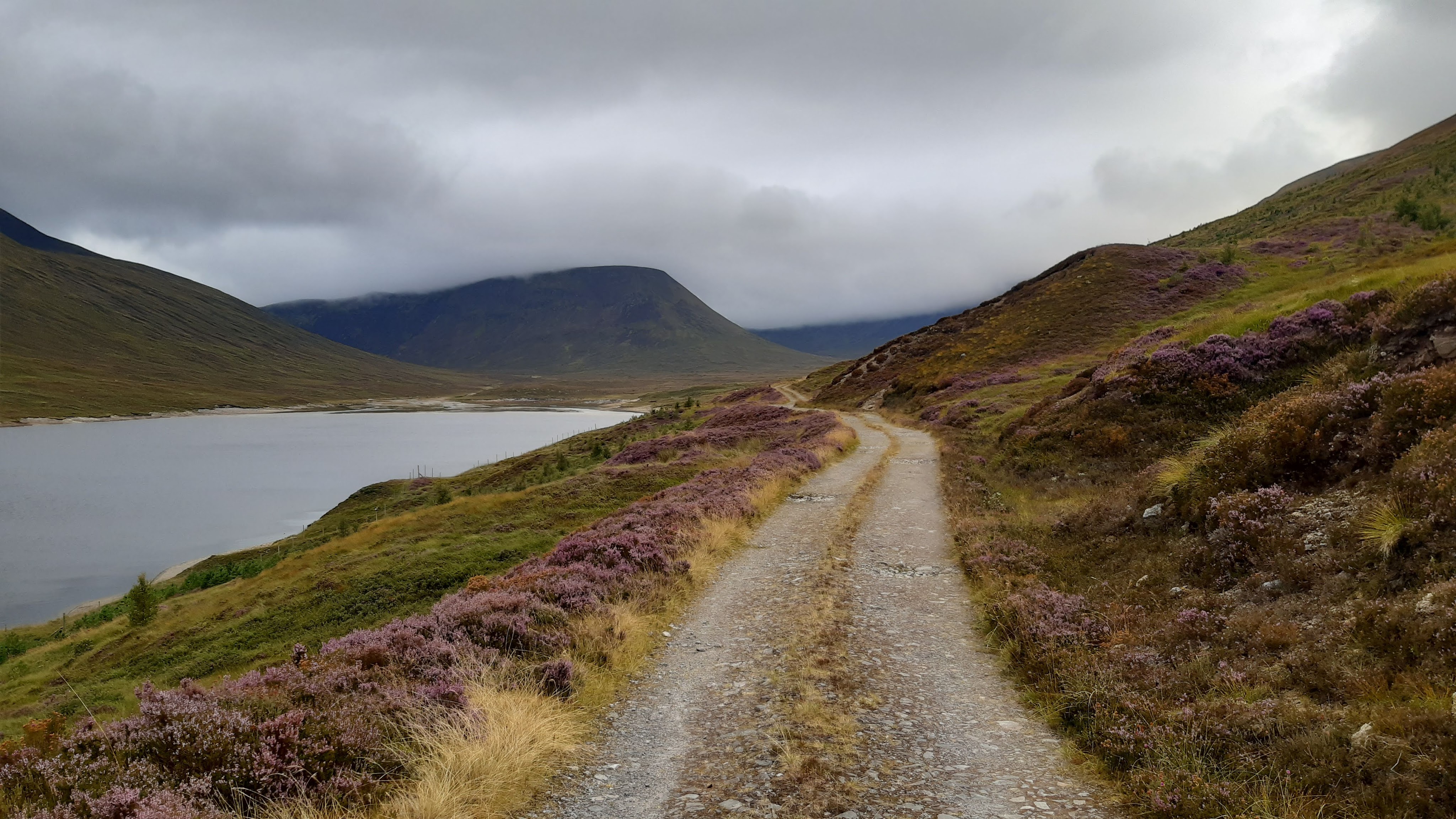
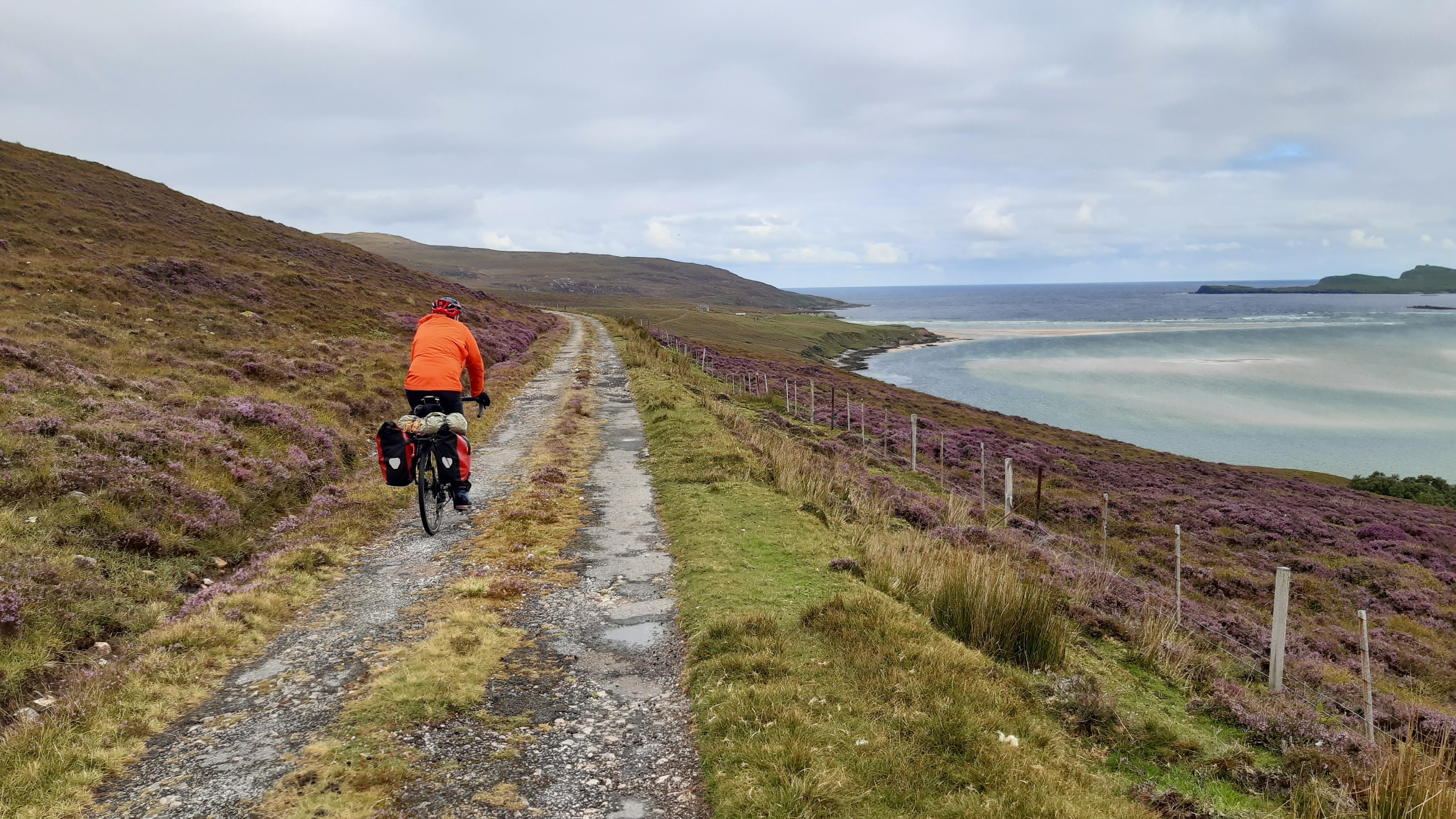
This climb wasn’t easy, but if you keep chipping away at it you’ll eventually get to the top. Once at the top the views open up to a large marshy section as far as you can see. This was one of the sections I started to feel like I was alone. It was very quiet with some boggy bits to push and carry your bike over, but thankfully once you past this mile or two long section it’s a sweet downhill on a well maintained forest track to Loch Rannoch where I set up my tent for night two.
This was the first time I ate one of my packed meals I bought from Tent Meals. Each pack contained 800 calories of real food that you just had to hydrate. Very much enjoyed these considering the other option to this would’ve been my own food concoctions that I would’ve prepared. Edible probably but not as nice.


Day 3 – Loch Rannoch to Corrieyairack Pass Summit (62 miles 5000ft elev)
Like the previous day I was up early, and thank god the midgies weren’t out in force this morning. I packed up the tent and camp as quickly as I could as there were still some but a manageable amount at least. From Loch Rannoch my next destination point was for breakfast at Rannoch station tea room. As I cycled towards Rannoch station it was cloud after cloud of midgies. I eventually put my net back on but they would get stuck in my arm, leg and beard hair and before I knew it I would be covered in bites for the rest of the trip.
Rannoch tea room is a special place. It feels like you’re out in the middle of nowhere, yet there’s a cute little tea room. Better yet it was eat out to help out day so the menu was 50% off thanks to the government. Unfortunately, this station was absolutely plagued by midgies. Even eating inside there were some that were having me for breakfast while I was eating mine.


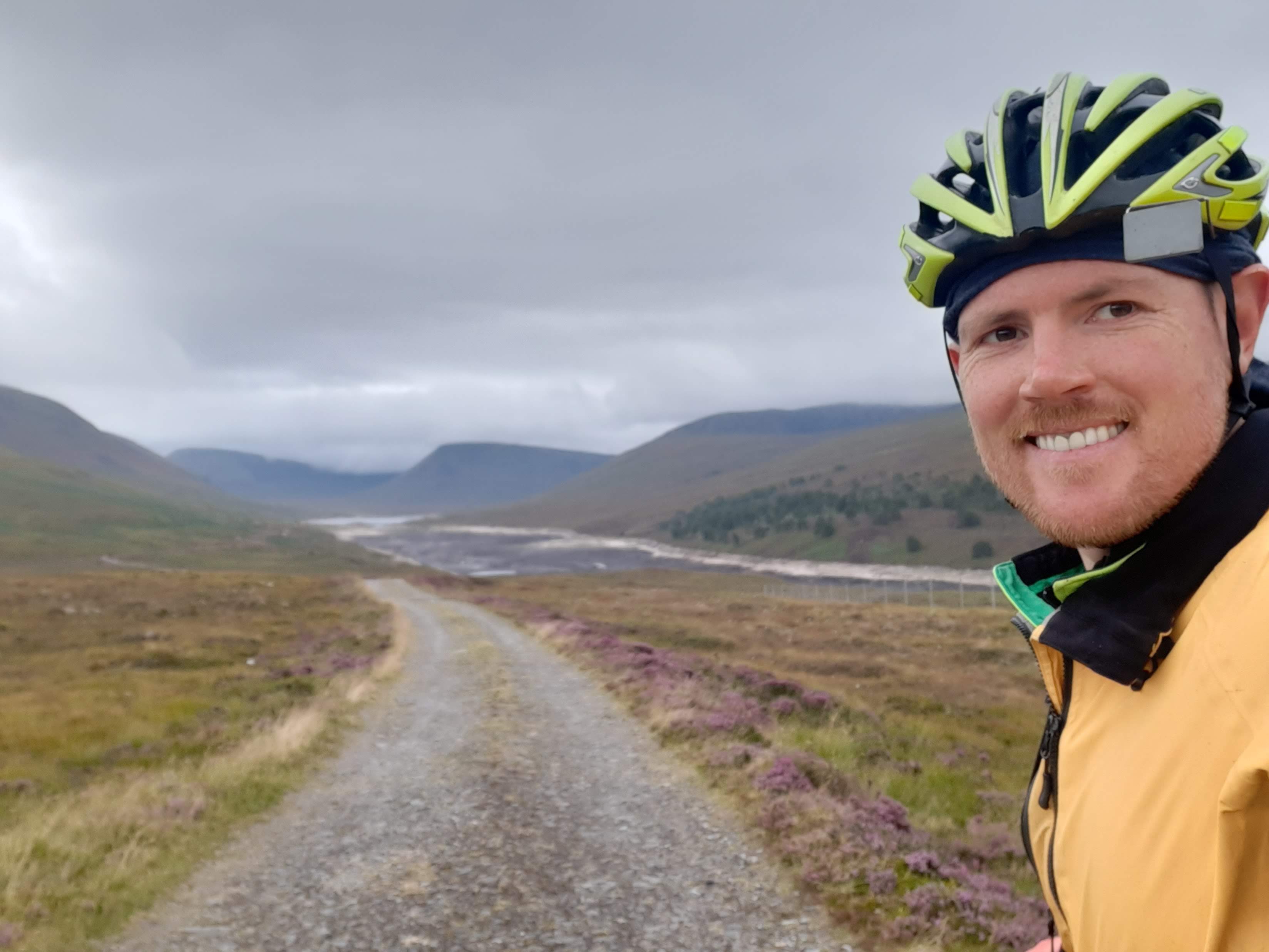
After a leisurely breakfast at the station it was time to head off. I really enjoyed the riding on this day, especially the climb out from Rannoch. Was a beautiful drove/military road with views of Glencoe and Scotland’s tallest peak Ben Nevis. As I’ve been to these two places on previous trips with family it reminded me of the good times we’ve had in these spots and almost felt like if I went over to either spot they would be there waiting for me.


It was a beautiful day and what was even more beautiful was that I was heading towards another great food spot at Corrour station. As I moved closer towards the station I past Loch Ossian youth hostel. It’s one of the few YHA’s in the UK that you can only access by walking or cycling to. Unfortunately, it was closed due to COVID, but I hope to return sometime. When you’re accompanied by folk who have had to work to get to a place, I often find the reward is you’re with a select few that you’ll share a lot in common with.
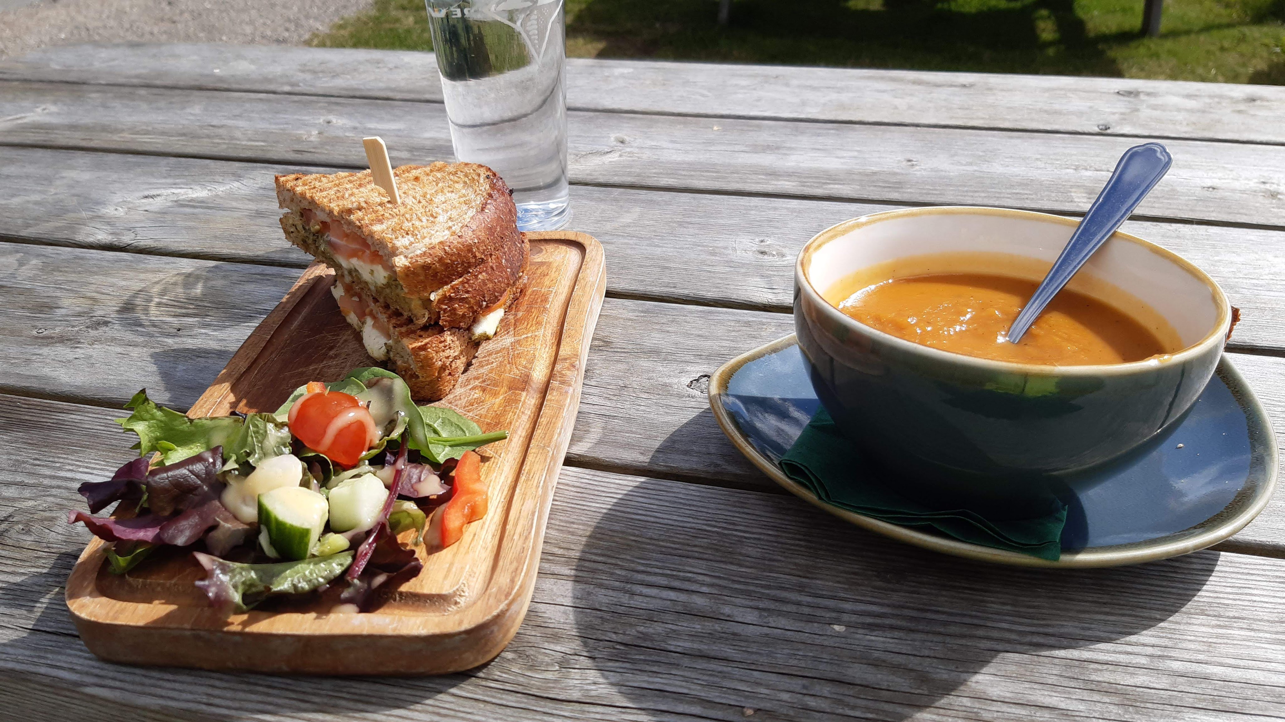
It hadn’t been long since breakfast, but I knew I had a long day ahead, so I ordered a delicious mozzarella, basil and pesto sandwich with homemade tomato soup from Corrour station. It was delicious. The people that work there also live there for months on end. It must be a nice to live in such natural beauty, around the quiet of the mountains and so many amazing outdoor opportunities during the warmer months of the year.


The section after this station after you cycle around the mountain was one of the best of the ride for me. It was smooth gravel tracks with a slight downward gradient. What more could you ask for? The sun was shining and the miles were easily ticking by.


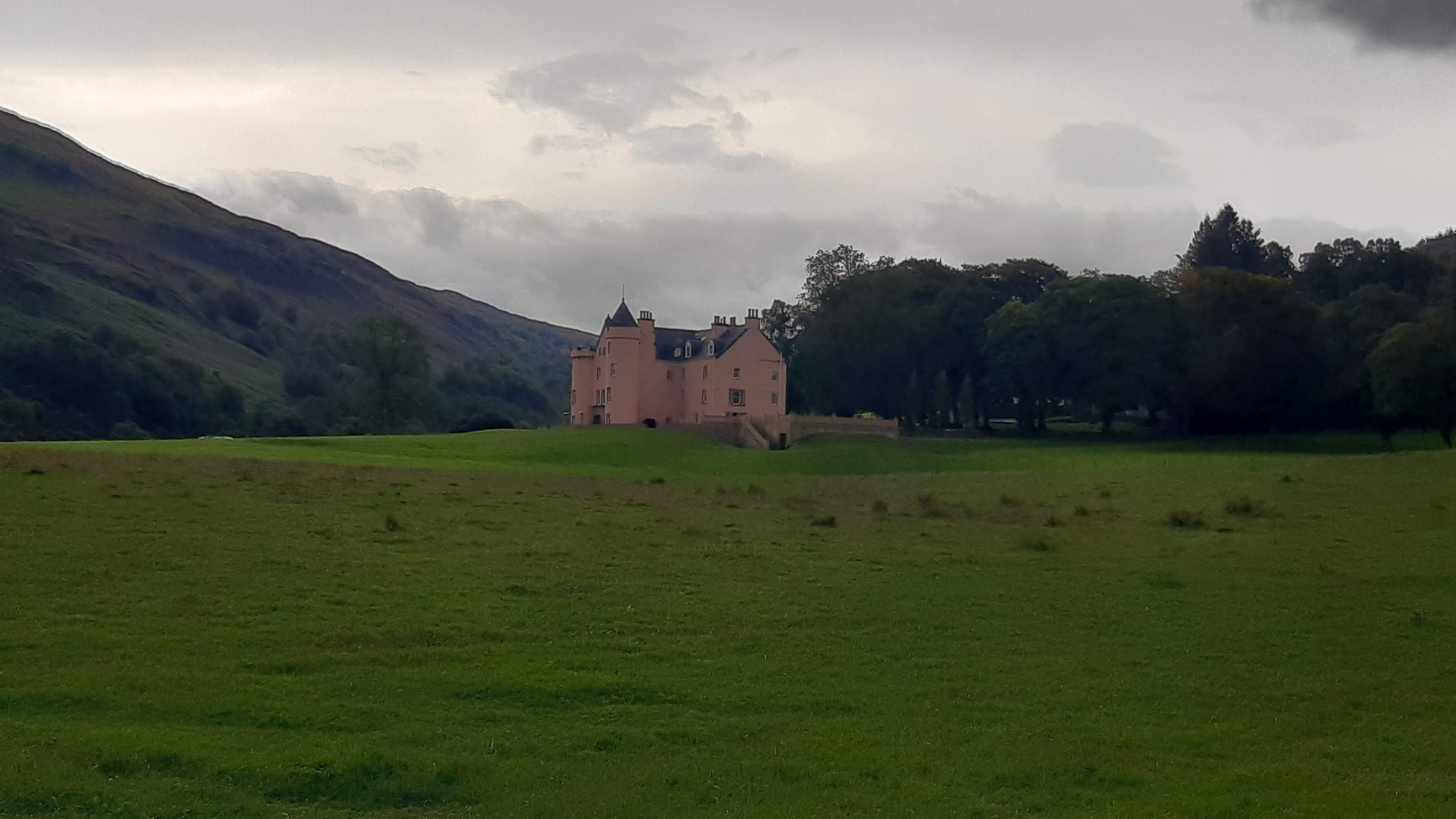
Had another stretch after this along a never ending loch. It was easy miles but flat as a pancake for a good while. Then out of nowhere a massive castle appeared on the trail. Apparently this castle has been used in film and tv shows. As I continued on past the castle I was passed by expensive SUVs going the other direction towards the castle and couldn’t help but think what life would be like having that as your home. I’ll keep dreaming!

A bit further on after the estate you head out onto an A road for a mile or two before heading back into the hills and woods. Wasn’t too much of a climb but the views back towards the castle and straight ahead were beautiful. At this point in the day it was around 3 or 4pm. I still had Corrieyairack Pass at the back of my mind and trying to figure out if I could do it today or wait until tomorrow. This pass is unofficially the tallest road in the UK – which thankfully I didn’t know until AFTER I did it. I had done the Bealach na Ba climb a couple years earlier on paved roads and thought it was a big one.
First step was seeing if I could even see the pass from the road. As I cycled on and closer towards the pass I couldn’t see it, but my Wahoo was showing me that I was close to the start of the climb. I filtered some water at one of the many streams to make sure I had enough before I took on this climb. Spoiler alert, I didn’t need to as Scotland has a stream every 10 feet it seems. Still, coming from the hot and dry of California I’ve been conditioned to always make sure I have a full bottle before attempting something arduous.
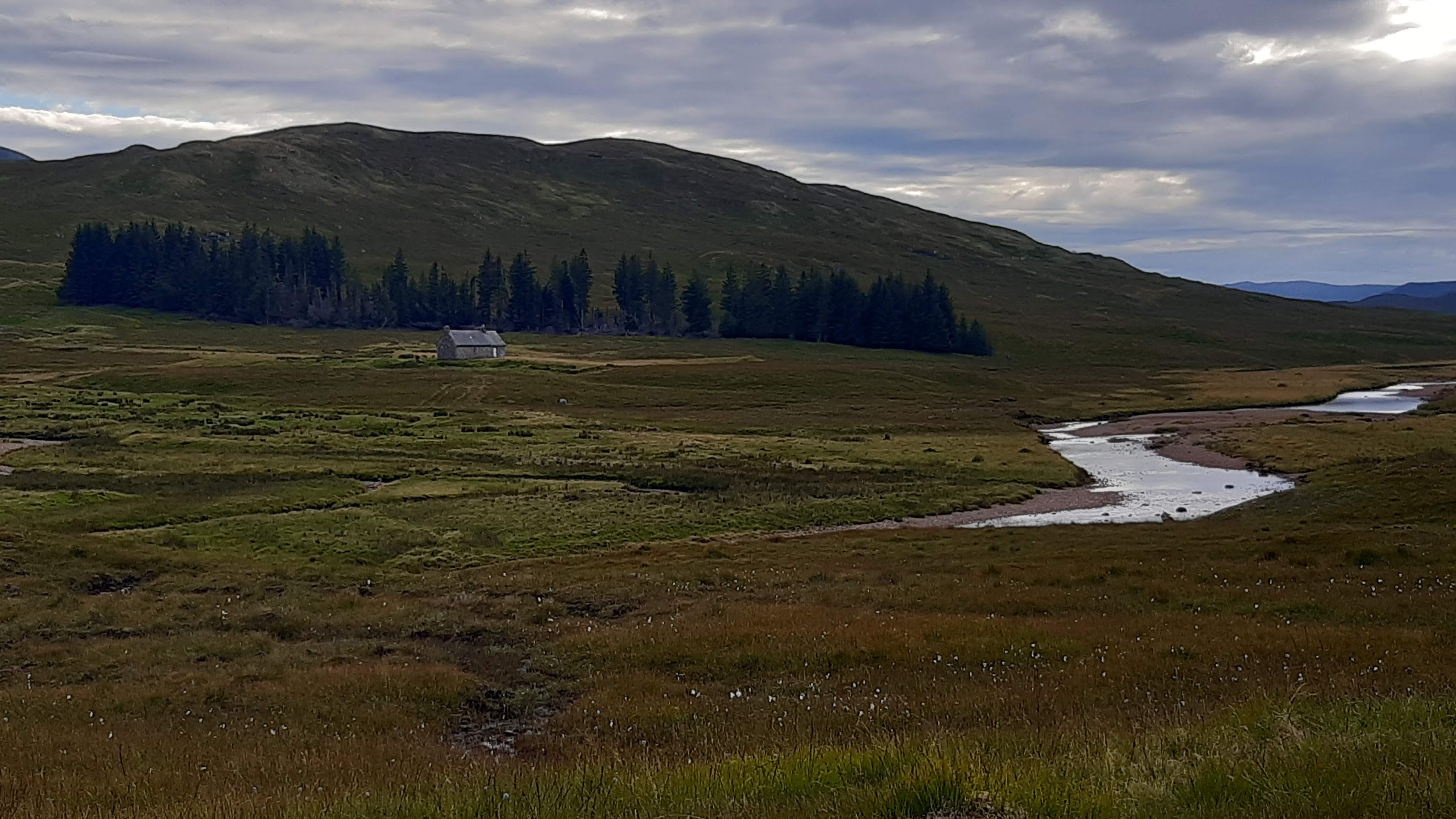
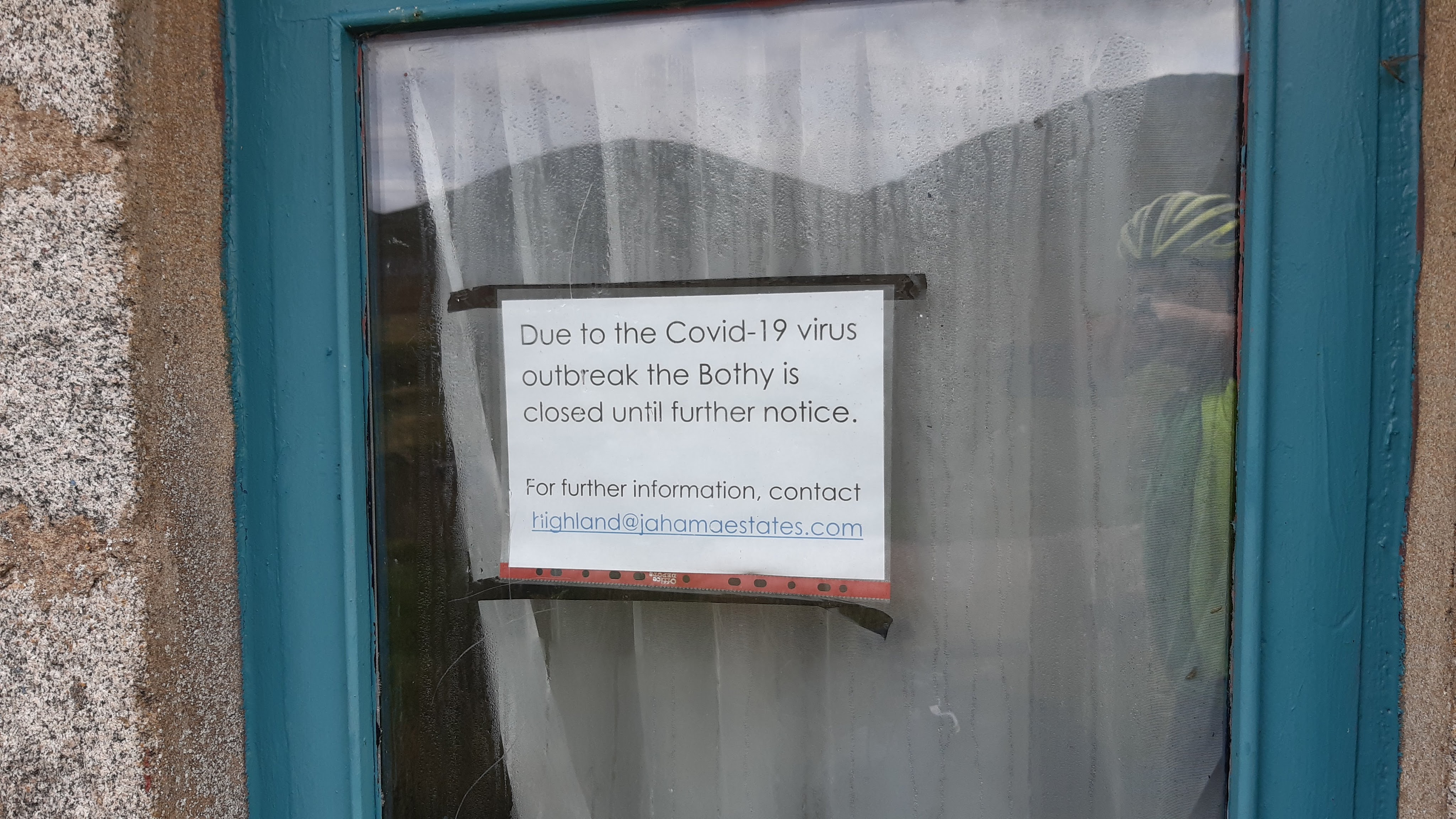
The landscape was getting lonelier and lonelier as I moved towards the pass. Even in the distance you could make out small bothies, and one closer to the road right before the start of the climb. All bothies are currently closed due to concerns over COVID which is a real shame as they add so much to an experience in the highlands.


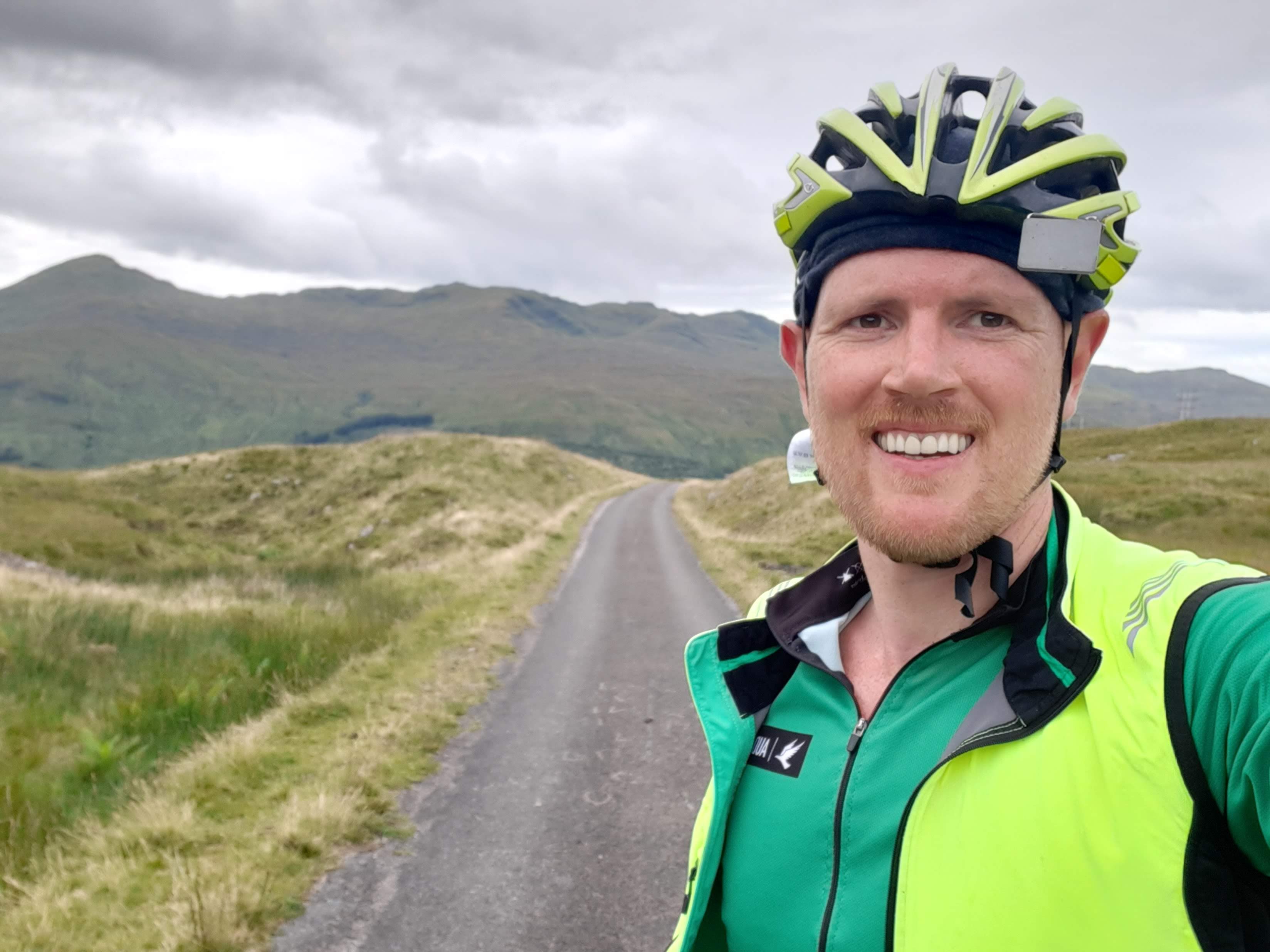
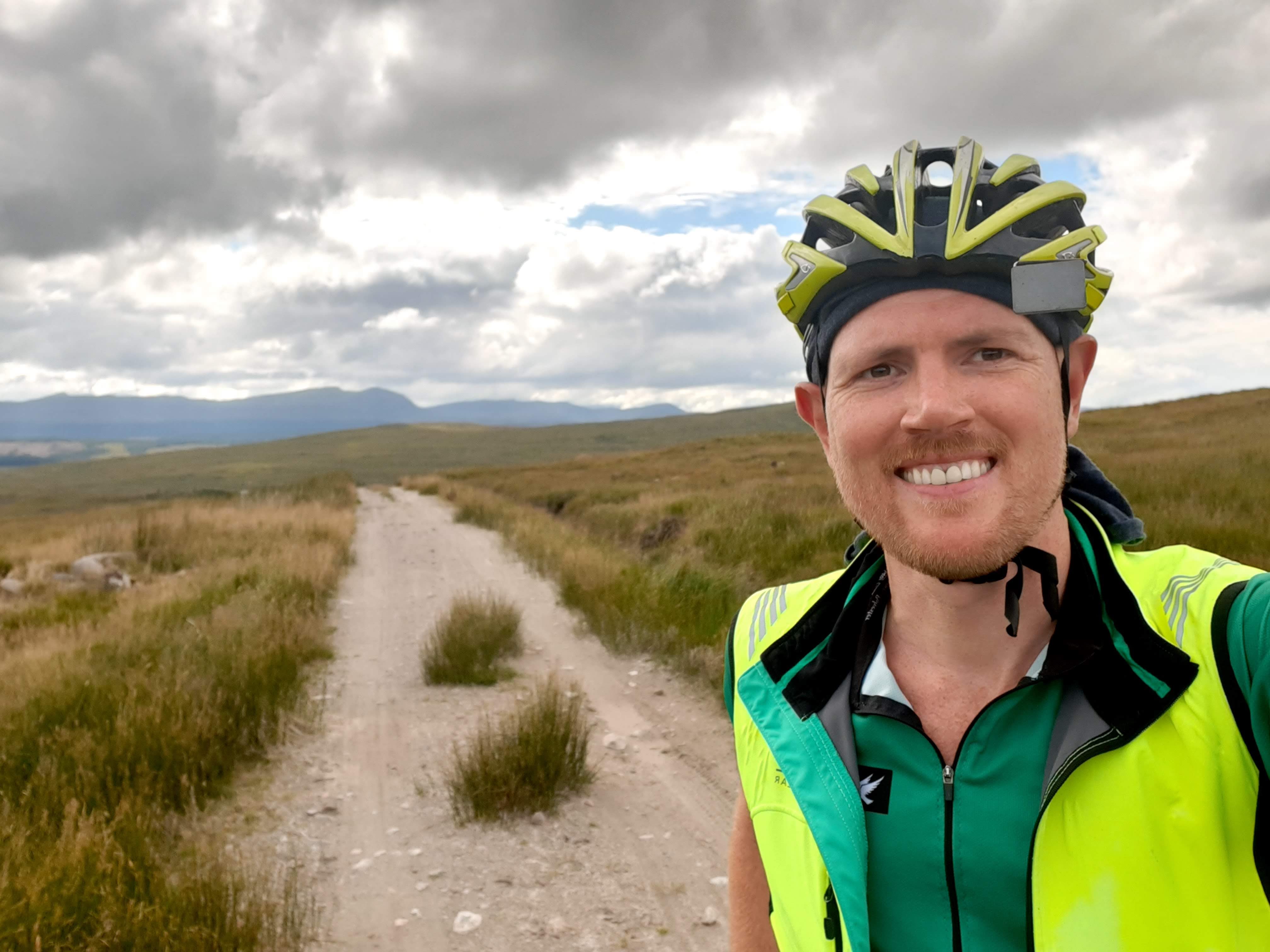
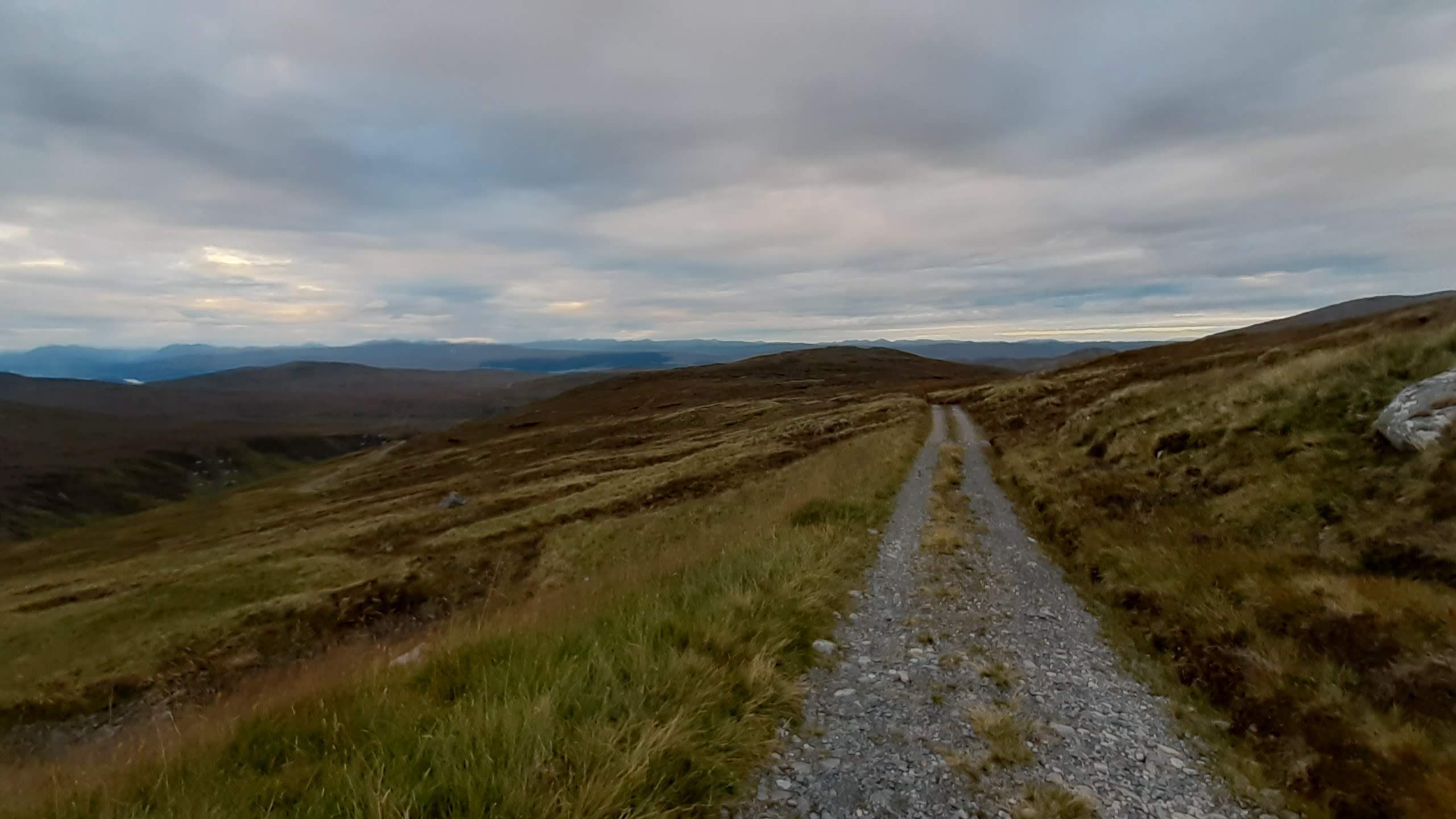
The climb begins up a gravel path at a fairly low gradient. The only pain was the slabs of stone every 50-100 feet which I’m guessing are to help so the trail doesn’t completely erode. Of course this meant me having to get off every 50-100 feet to carry my bike over them. I’m sure the more skilled could cycle over them, but as I was on my own and don’t really care about style points (see Helmet mirror) I just played it safe.
The climb wasn’t terrible, and actually the day was very nice. Granted it was about 7pm or so as I was doing the climb, so I was deliberating whether to camp or not on the climb, but ended up deciding against it and carrying on. The pass itself isn’t too bad until you hit the switchbacks. The switchbacks are difficult as I found them completely unridable and you’re just pushing your bike up the hill and at points trying not to slide down the hill as you push up. Mentally I was prepared for a very hard climb, so I imagined I would probably have to push at some point. The goal was to get to the top of the mountain before the dark set in as I did have lights but forgot my head torch so knew it would be extra hard to set camp without one.
I made it to the top with daylight to spare thankfully. It was a difficult last section to the summit. Thankfully the quality of the track on the way down was much better and I could cycle down the whole of it.


Next up was trying to find a good spot to camp. Not learning my lessons from the previous two nights I found another stream and thought I could camp by it as well. I began unpacking and changed into my night clothes only to be completely swarmed by midgies. It was terrible. There were so many it felt like rain was hitting my net and the sound of a swarm of them is another kind of hell. So reluctantly I hung my dry bags full of stuff on my handlebars and pedaled off in my evening clothes hoping to find a better spot soon after. Thankfully just around the corner was a wide open glen with enough wind to keep them away. This was one of the few nights there wasn’t a full moon or cloud cover and I could clearly see the milky way outside of my tent at night. One of the many bonuses of camping.

Day 4 – Corrieyairack Pass Summit to Tomich (26 miles 3000ft elev)
This day was the turning point of my trip. I was cruising along from the previous days, but it would all start to catch up with me today and I never really seemed to get my juice back after it.
I awoke early, midge free, and packed up camp to head into Fort Augustus and visit Nessie. There was a cafe I stopped at in town and bought a double breakfast sandwich, hot chocolate and some extra supplies for the road. Another 50% off meal which was welcome.


At this point I had planned to keep up my 50-60 miles a day as I was fine doing so before, but I didn’t realize the two climbs that would be waiting for me today. The first one out of Fort Augustus was more of walking path then an off road ride. Lots of overgrown plants so I decided to walk most of it until I hit the forest path. Once on the forest path it was a gentle climb to the first river ford of the journey. It was raining and I wasn’t particularly looking forward to getting my feet wet even though I had brought croc sandals just for the occasion. Thankfully the river was low and I could use the stepping stones to cross. The guidebook says the next section is lovely single track riding. Yes, that is correct, however there are these grass mounds all over the track which bounce you around if you’re not careful to avoid them or go over slowly. As I had no suspension and still a fairly high psi in my tires it wasn’t the most enjoyable ride but was beautiful nonetheless.
The single track soon became an old military road and I was cruising down the mountain and feeling pretty good. That would soon all change before the next behemoth of a climb.
The next climb I felt was the hardest of the trip. I know it wasn’t as tall as the previous days climb, but it was brutal and seemed to go on and on with difficult gradients, high wind, and that wonderful sideways Scottish rain. It was an epic climb, and those types of climbs make for good stories down the road so I’m glad I did it but it was difficult.
It all started off the main road and you quickly head into a nicely maintained forest gravel track. Clearly lots of work is being done in this area for a hydro/electric/forestry scheme as it looks heavily used. However I didn’t see anyone on this climb. I think I ate 3 heavy bars all at once on the bottom of it. I just couldn’t seem to eat enough, or perhaps I was just eating my stress as I was going up this thing. I was able to cycle a good portion of it, but sometimes the gradient would kick up and I’d worry about toppling over so I just got off and pushed.
The climb was long and arduous with switchbacks at the top. The wind made it difficult to go in a straight line as you had to dodge large rocks and washed away track. Once finally at the top, it wasn’t actually the top but a false summit that carries on for some time more. At this false summit you’re more exposed to the wind and rain. There was definitely cursing involved at this point, a bit akin to Truman yelling at the storm in Truman show. Eventually I would hit the top and begin a cold and wet descent into a forest where I would hide under a tree for a bit to change into my warmest clothes and have a quick snack. I wish I took a picture of this forest as it was very beautiful, but I was just too miserable to get my camera out!


Shortly after the forest section it opened up to a small paved b road. This b road would take me to my unplanned overnight stop – the Tomich Hotel. You feel like you’re out in the middle of nowhere in Tomich. However, Tomich is the birthplace of the Goldien Retriever breed. I had no idea! The staff at the hotel were very kind and welcoming as I decided to stop in for a late lunch and to dry off. There was another group there warming up by the fire and we got to chatting. Before I knew it a couple hours had passed and I was quite comfortable where I was and decided to have a proper wash, clean my clothes and stay the night. It was a good choice as this was one of the wettest days of my trip.


Day 5 – Tomich to Loch Vaich (48 miles 4000 ft elev)
Today was difficult, but thankfully no climbs as hard as the the previous day. Heading on quiet paved roads for a few miles before taking the turn off on the gravel track towards Orrin Dam. This track has been described as the road of 1000 puddles. It’s correct! There were lots of puddles and muddy holes to carry the bike over or ride through. The riding wasn’t terrible but it wasn’t consistent riding and at times required pushes up the steeper sections. Unfortunately the main road that goes past Orrin Dam is shut during the week because of work that’s being had on the Dam, so the detour was a 5 mile single track through a boggy, overgrown and midge infested section. The organizers did a tremendous job on this route, but this detour past the work site was awful. Luckily, I was a fast walker and was determined, but it wasn’t fun carrying your bike through brush and mud. I wish I had skipped it, but I’ve lived to tell the tale and that’s all that matters! After a slow 20 mile start to the day it was all downhill towards Contin which would be my last shop before Durness – meaning 2 days of self sufficiency. Exciting! Glad I came prepared with a cook set and dried food.


I really enjoyed the Contin store. There were cakes and sweets in there that I had never seen before including these absolute sugar bricks from Nevis bakery which were 3 layers consisting of a chocolate shortbread crust, mint fudge in the middle and chocolate top. Each one of these must’ve been 500 calories easily, but they were damn good when you know you’re burning it off!
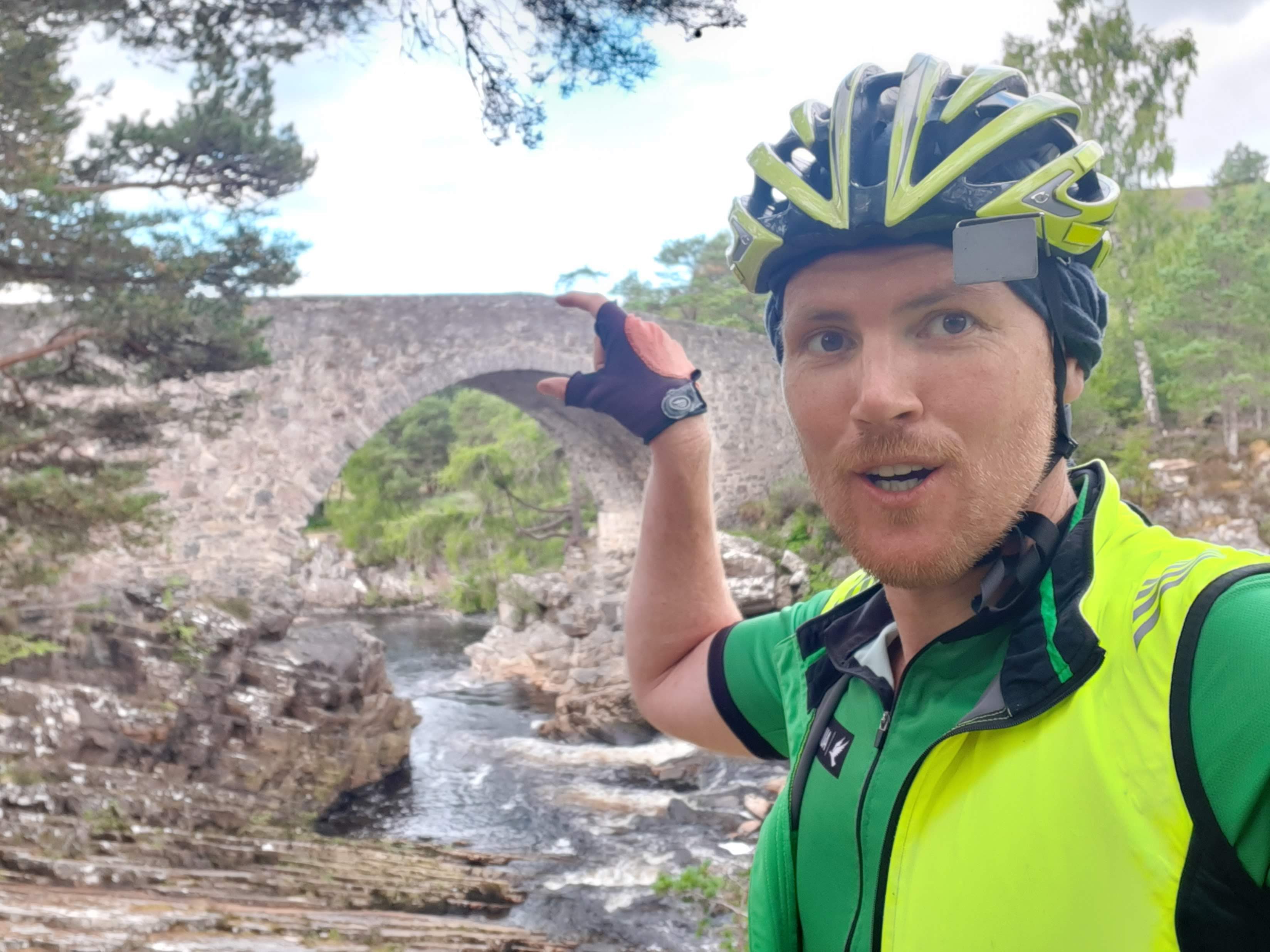
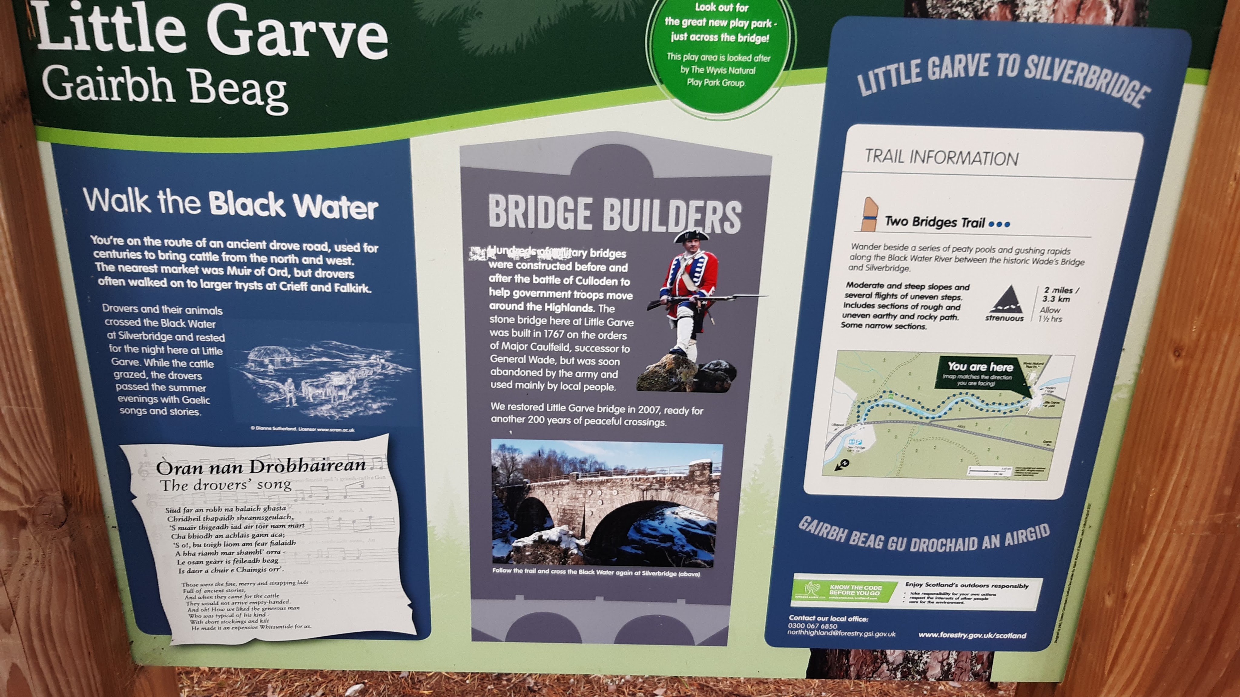
From Contin the miles were much easier. Heading into another forest track for a few miles, past a beautiful old military bridge and into another forest before heading onto a main road for a few miles. This road is quite busy during the day, but as the night was approaching it was very quiet thankfully.


It was approaching 7 or 8pm so I knew I needed to camp for the evening soon if I was to do so in the light. Everything was fairly calm, and there was a nice river ahead and could be a good spot to camp by. This was of course another midgie night and the worst one of the trip. They waited for me to get all my stuff out and almost set up then went after me. At this point in the trip I was getting dressed in my long rain trousers, long gloves and socks with midge net etc, while also tucking my socks and gloves into my trousers and jacket to keep them out. I had a good routine, but it still was awful when they swarmed you. My technique was to run away from my tent, then run back towards my tent and open it and jump in before they got me. This didn’t totally work, but I don’t really want to go back in August to hone this skill either.

Day 6 – Loch Vaich to Loch Shin (60 miles 4000 ft elev)
The next morning I got re-dressed inside my tent, packed everything up inside and then went outside to brave the hordes of midgies again. I got the hell out of there as fast as I could and cycled for a few miles until I was out on a windy perch to make porridge for breakfast. I really enjoy porridge, especially when you have some nice things to put in it. Filled up my bottles at the stream and then was off again.
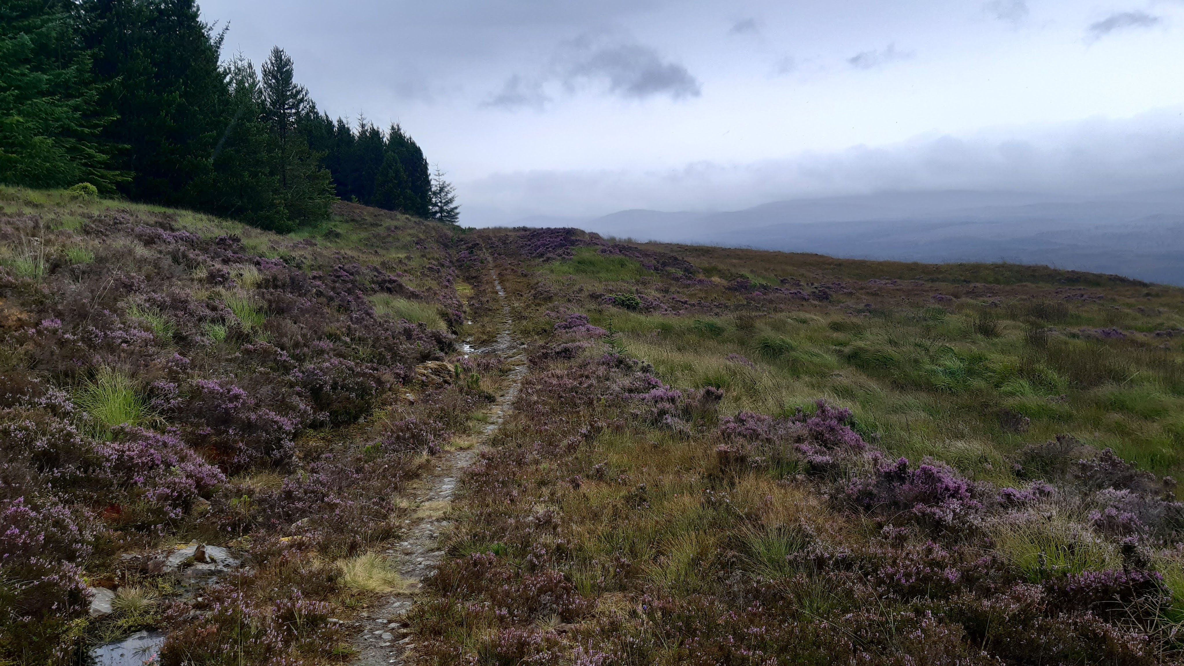
This next section was very beautiful and remote feeling. Bothies, mountains, lochs and good off road riding. This is why I came to Scotland to do this route. It was a perfect day.


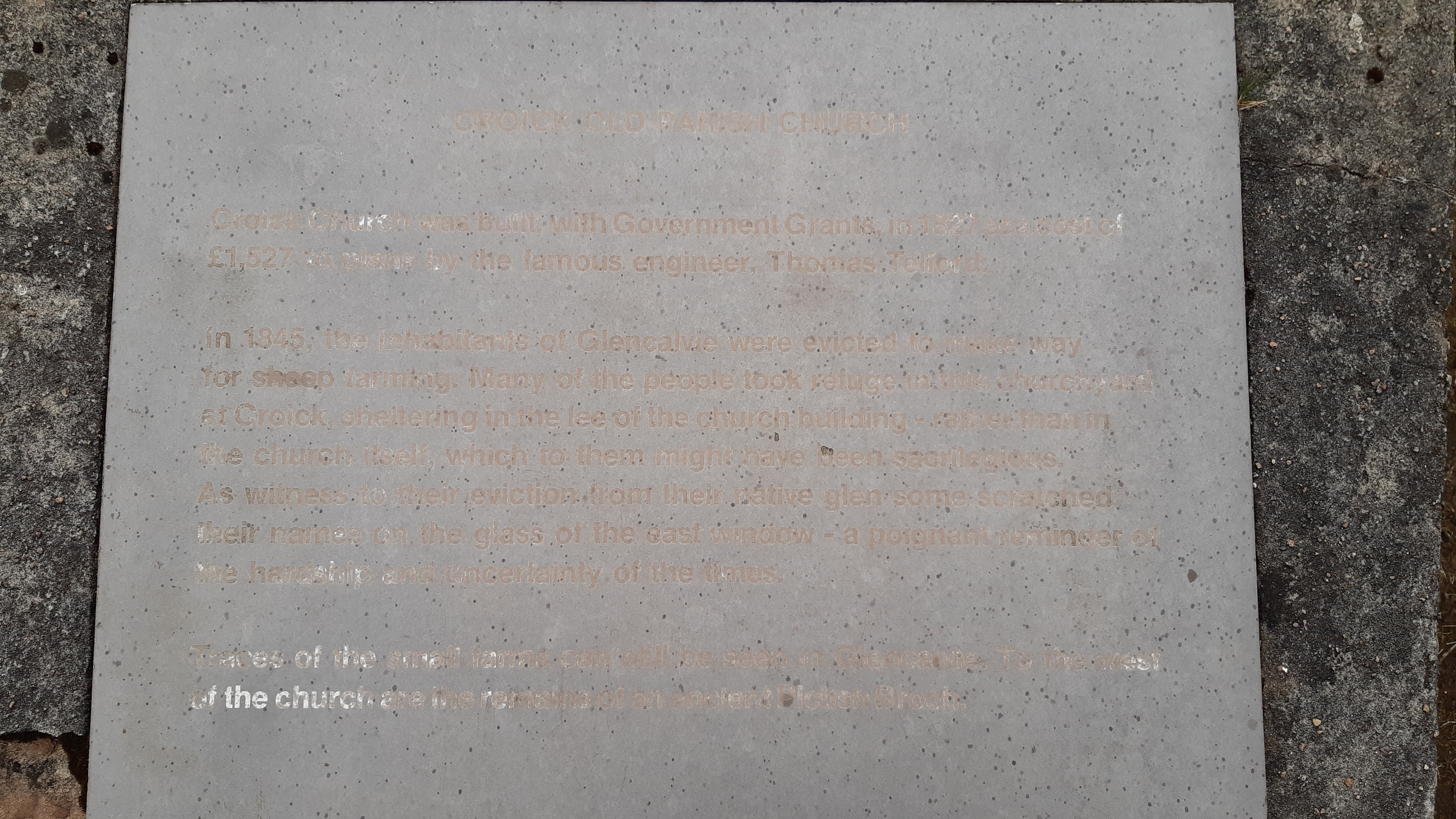
En route I ran into some walkers from the Alladale Reserve. Apparently I spoke to the owner of the reserve who was a man that lived in Notting Hill his whole life, but decided he had enough of the city and moved to the heart of the highlands for work and peace. They are trying to reintroduce wolves into the area to help with the deer population. The deer are a big part of Scotland but as I know from living near Richmond Park, they can get out of hand when not culled as they have no natural predators. After a bit of a chinwag with these locals I was off towards Croick Church.
Croick Church was one of the most memorable places of the whole trip. It painted a sad picture of the crofters that were forced to leave their home from the Clearance of Glencalvie in 1845. During this clearance the crofters sought refuge in the church graveyard by creating a common shelter of makeshift tents. During this occupation of the church yard, these refugees scratched their names and dates on the east window. Reading history books is one thing but seeing the visible history of these etchings was very moving. To imagine people living in this church yard for a short time after being removed from their houses over 170 years ago is a strong reminder of the cruelty of men to their fellow man for profit. Something which sadly continues in abundance today still.
In the church yard I met a Scottish man from Inverness on a short holiday with his black lab. Gave the black lab a pet and chatted for a bit with him about the history of the area.
Before long I would saddle back up and head out onto a quiet gravel track through the Glen for 20 or so miles.


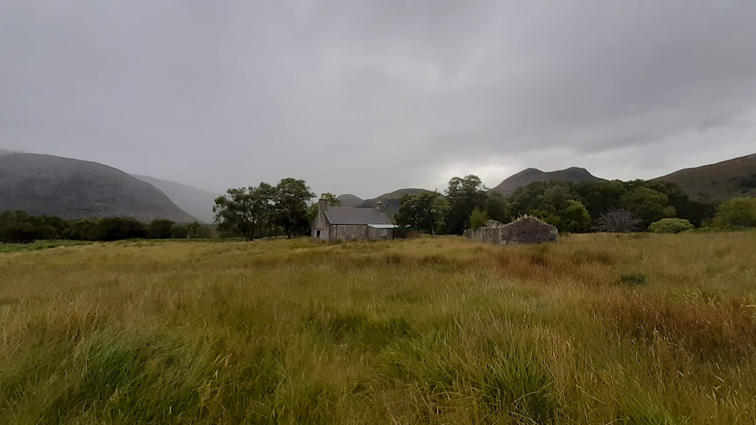
The next stretch was a very contemplative one. With everything I saw and learnt back at the church I couldn’t help but imagine the Glen full of life at one time with many families. Now the Glen is dotted with piles of stone and rubble that used to be old crofter shelters. A couple modern farming facilities are situated in the Glen as well as herds of sheep and wild red deer roaming the area.
It was smooth moving through the next few miles, and even ran into another person that was doing the An Turas Mor/ Great North Trail but from North to South. When you’re solo out in the middle of a remote spot it welcomes a chat. Living in London for so long you’re conditioned to leave people alone and let them be, but people are social creatures and it is a welcomed change to be in a place where you can meet other people that share your interests in nature and the outdoors.
After a long downhill through another forest access road the trail wound up again and spit me out on a main road for a few miles before I hit Rosehall, the final point I could resupply for a day or two. Unfortunately, the hotel was closing for food at 3:30pm. Seemed a bit odd, but after living in Cornwall for the past 5 months during lockdown I realize locals sometimes just want the afternoon off. No worries as I had enough food for a couple days and stopped river side to cook one of my meals.
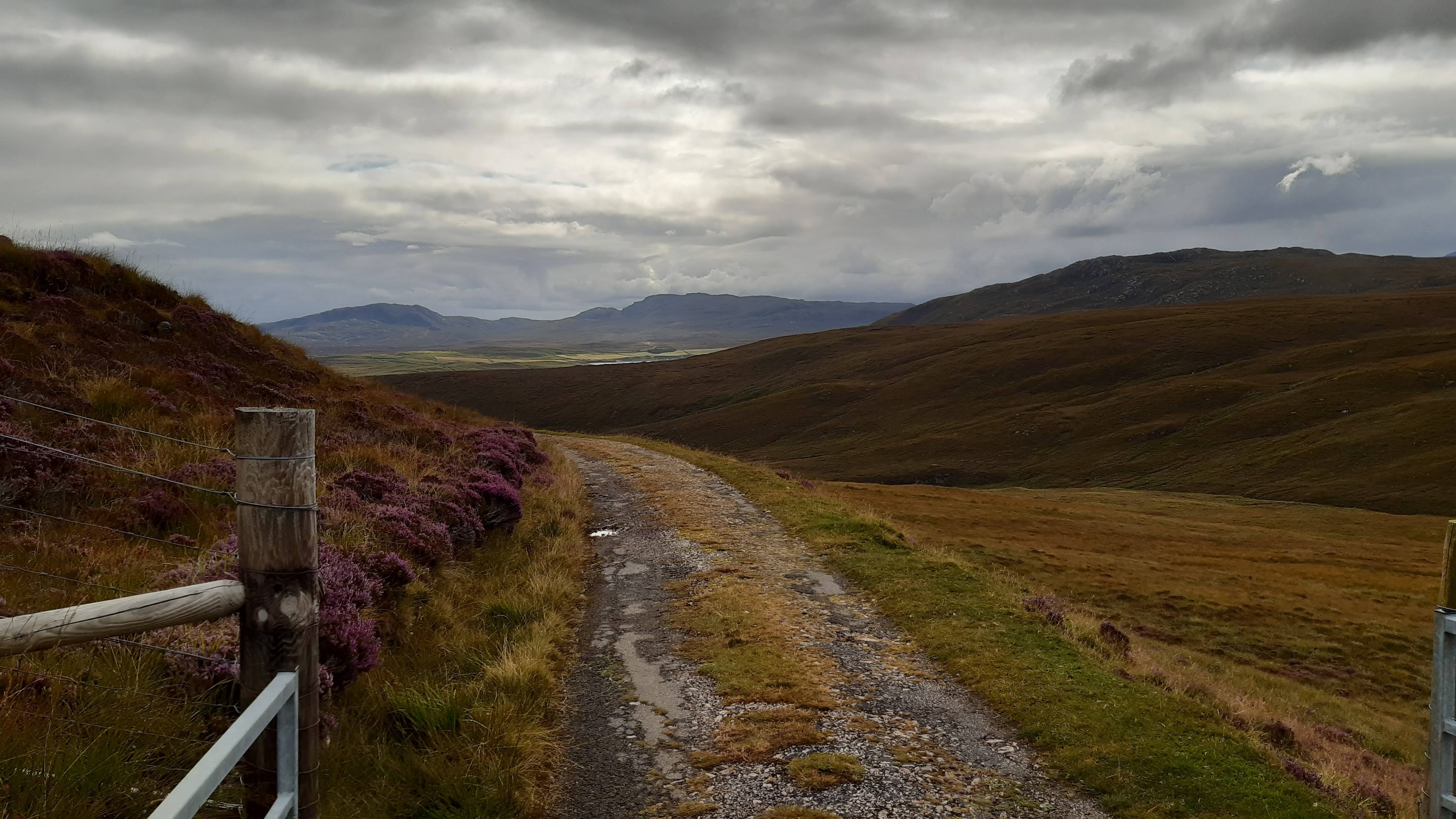
From Rosehall it was a long road ride on a quiet b road that seemed to go on and on to the middle of nowhere. It was another quiet glen where I wouldn’t see anyone for hours.


At the end of the glen the road disappeared and it was back to off road tracks again. The climb didn’t look incredibly difficult, and the first part wasn’t, but later down the road after hugging the river for a bit the road kicked up at the dam. How happy I was to see that this road was tarmac though. It was towards the end of the day, and I was tired, but had enough in the tank to get me up this hill. It was steep for a great deal of it, and and I could see the low lying cloud/mist/rain that awaited me at the top. Luckily, if you keep pedaling you can stay warm and get through most bad weather without issue. It was eerie at the top as the visibility was very poor due to the fog, but I knew there was a big downhill coming up which would drop me down towards Loch Shin where I’d wild camp for the night in some boggy section near the loch.
That night setting up the tent wasn’t an issue as it was raining and windy, but the following morning it was calm and warm, which usually is perfect, but in Scotland during August that means only one thing. MORE MIDGIES! Thankfully they hadn’t worked out how to get under the rain fly so I was safe for a bit as I had to cook breakfast still. I knew I couldn’t cook in my tent so I prepped it all then quickly opened the tent and put the stove and pot outside to light it. Once lit I waited for the water to boil for a few mins. Once boiling I checked the pot again to find it had loads of burned midges on the top of the lid. It was gross and suffice to say I did end up having some midgies for breakfast in my oatmeal as I couldn’t get them all off the top of the lid.
Day 7 – Loch Shin to Durness (41 miles 3000 ft elev)
After that I was off to Durness for my final day before Cape Wrath. I cycled the remainder of the way past Loch Shin and Loch Merkland towards one of the more beautiful off road sections of the ride. However, it was very wet for about half of it, so was difficult to fully enjoy, but thankfully the weather broke and sun came out for part of it.
As the scenery and clouds opened up I could see Ben Hope in the distance with some beautiful sunshine on it before I dropped down into a valley with a posh hunting lodge. From that lodge I took a short forest track up to a minor road that hugged the mountain side for a bit before I went back off road towards the Cashel Dhu river ford.


As someone that’s followed the Highland Trail 550 I have a healthy fear of river fords in Scotland. Seeing pictures of people carrying their bikes through waist deep fast flowing rivers seems insane to me as at the end of the day safety is more of a concern than putting yourself in a possibly life threatening situation. However, the water level was low at the ford and I had my swanky croc sandals to see me over the ford which was no higher than 1.5 feet at the deepest spot. Once on the other side I cooked myself lunch using one of the tent meal packets and savored the moment as I knew I had one more climb before heading onto the busy NC500 route.


I felt at this point like I was on my victory lap. The last off road section before the busy NC500 was very enjoyable. I almost wish I could’ve reached Durness by the alternate ‘race route’ instead of riding on the road for the last 15 miles or so.
A few years ago I road a large portion of the NC500 and it was calm and quiet, but this year, most likely due to COVID and it being high travel season, it was completely rammed with motor homes, motorcycles and cars. Thankfully people were friendly, but as the road is mostly single track with passing places, it took a lot longer than I thought it would to reach Durness. I was a bit grumpy about this section after having miles and miles of empty dirt track to myself for so many days. I think ending at John O’Groats would’ve been a busy spot as well which wouldn’t have really fit with the theme of the ride, so I’m glad I opted to head towards Cape Wrath for my ride end.
Once into Durness I needed to find out how to contact the ferryman to take me to Cape Wrath tomorrow morning. Luckily the Great North Trail forum was very helpful and provided the phone number of the ferryman who agreed to meet me at the pick up point the following morning at 10am.
I liked Durness and the shopkeepers I spoke with. The pub I visited required you to call their kitchen to order, then wait for it to be ready to pick up. One of the best/biggest meals I had on the trip and only 9 pounds! For the amount of people serving at this restaurant I surely thought they could raise their prices.
After my meal I was off towards the ferry pick up point to see where I could camp for the evening and await my final day to Cape Wrath.


Day 8 – Durness to Cape Wrath Lighthouse (15 miles 2000 ft elev)
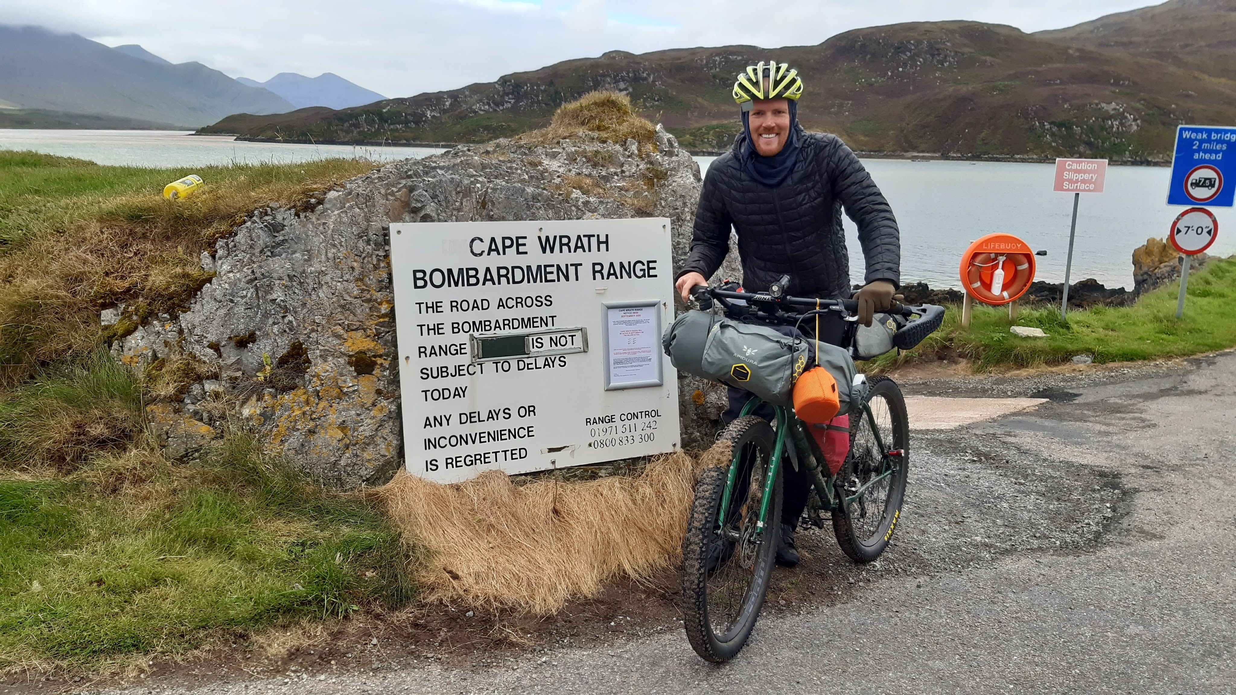
The next day I awoke to head towards the ferry where I was greeted by the ferryman and a few other people on their way to the lighthouse. Two walkers and another cyclist. It was a short ferry over to the other side and we agreed that we’d all stay over night on Cape Wrath and be picked up the following day. Apparently, he can see you from his house if you’re awaiting on the other side, but gave us his number just in case.
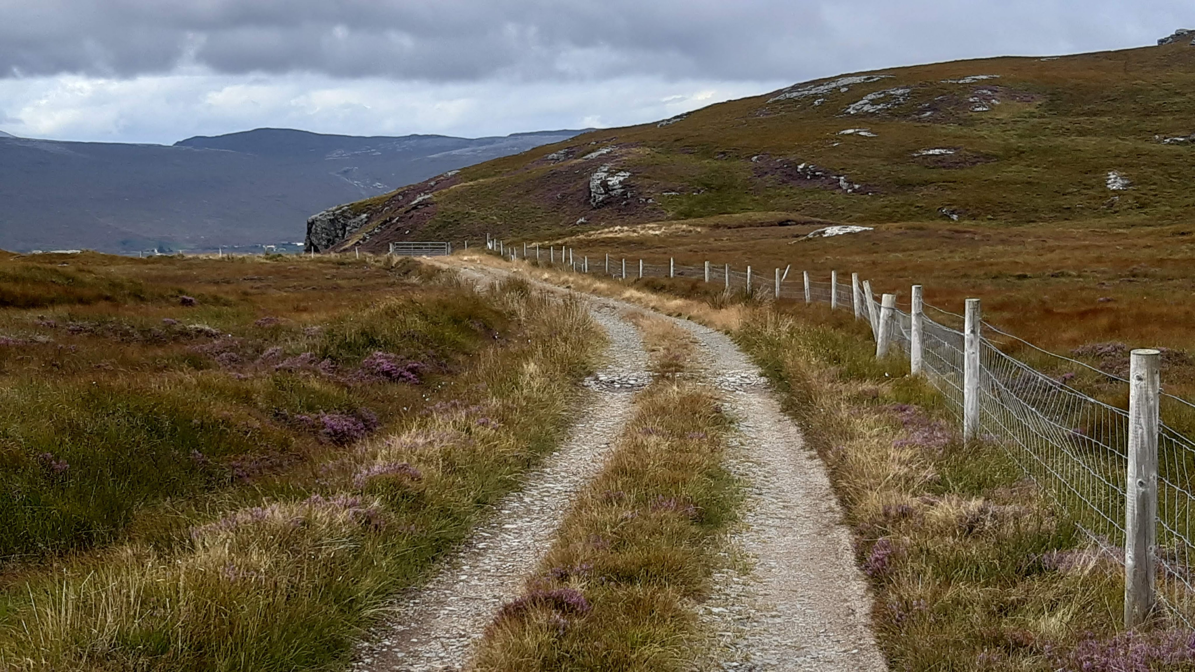
Once we arrived on Cape Wrath I began cycling with another person for the first time in over a week. It was nice to share the company and stories of the trip. As we were making our way over the barren landscape of CW we could start to make out artillery shelters and training areas for the military. It thankfully was not in action during August, otherwise that would’ve been a pretty deflating ending to a trip.
We took some photos around the ranges and continued on towards the lighthouse. As we cycled on we saw a walker making his way through the middle of a bog towards the road. It turned out he was just finishing the Cape Wrath Trail, which is dubbed as the most difficult walking trail in the UK. It spans from Fort William to Cape Wrath and goes through some of the most remote and wild places in Scotland. Suffice to say my achievement of almost reaching the lighthouse at this point by bike from Glasgow paled in comparison, but we ended up enjoying each others company later on in the day when he reached the lighthouse on foot.


As we turned the final corner we could see the lighthouse in the distance. It was a semi emotional moment for me as I had a pretty life altering injury last summer when trying to finish the North Cape 4000 in Europe. My back went out completely for a few weeks and was unable to get on a bike for a couple months after, so seeing the end of this ride meant a lot to me and gave me the courage and self belief that I could do the rides I love again – albeit a bit more carefully than I would previously do.
As we reached the lighthouse we took our respective photos and then hopped into the Ozone Cafe – the only cafe on Cape Wrath for a much needed lunch of homemade soup and sandwiches.


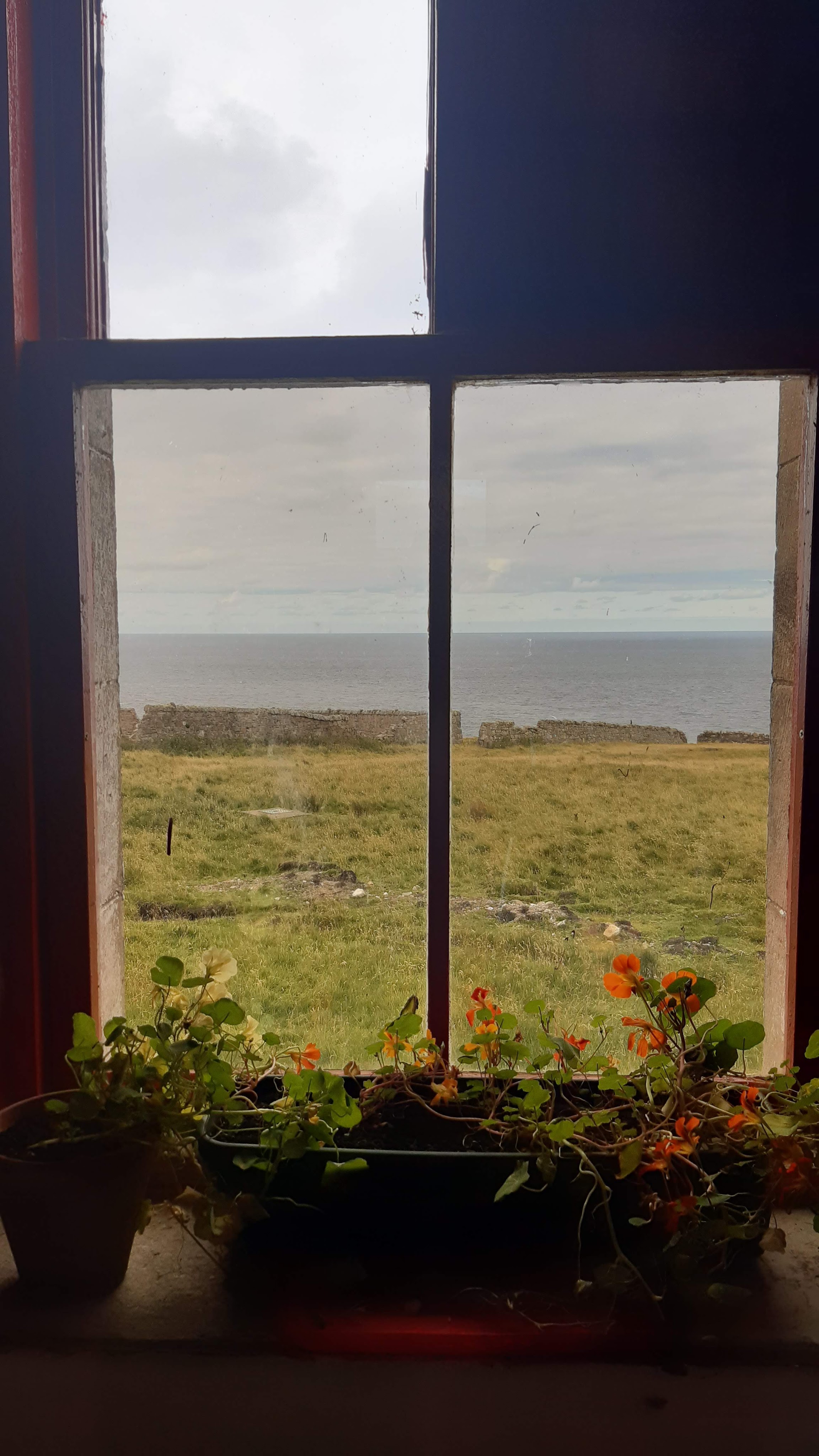
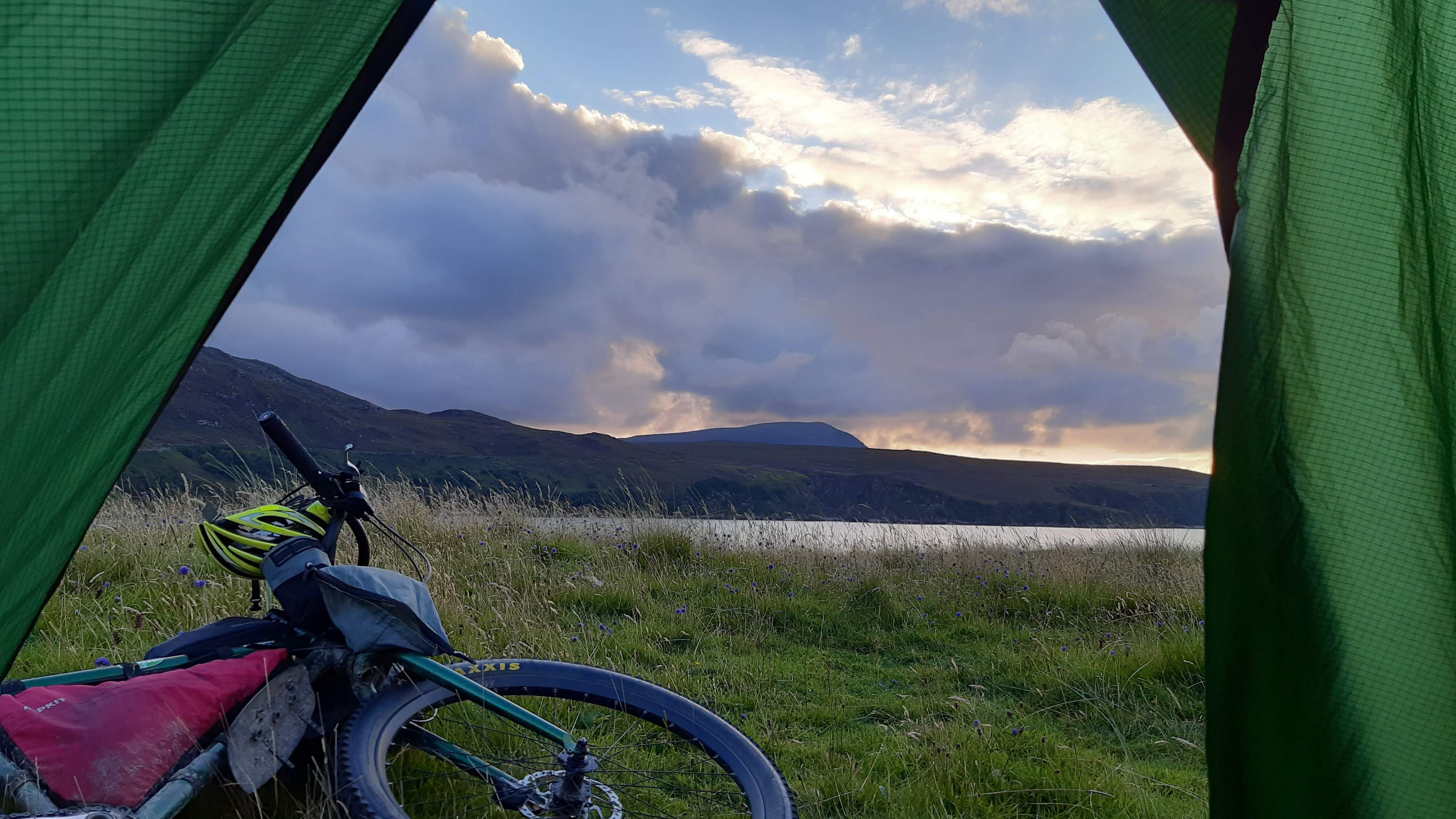
From the cafe it was a short ride to check out the famous Kearvaig bothy before setting up camp for the rest of the day. As we walked out of the cafe, the sky was blue, sunny, and it actually felt very warm for the first time in a couple days. So lucky to experience this. From the lighthouse you could make out the hebrides in the distance and some other smaller islands. Apparently the Vikings used Cape Wrath as a point to turn their ships. It was obviously still a popular point to this day as you could see loads of cargo ships off in the distance.
Then it was a short ride to the closed (due to COVID) bothy where we would dry out our wet gear and set up camp for the night nearby.
The evening felt electric as this was a very special place which luckily had wonderful weather for the one night I had there. You could see far out into the ocean, breath in the fresh air, and enjoy the warmth of sun on your face. This was a great final moment of the An Turas Mor route and really did make the entire route feel special. Cape Wrath can be a very inhospitable place from what I’ve read, so having a day like this could be once in a lifetime for me.


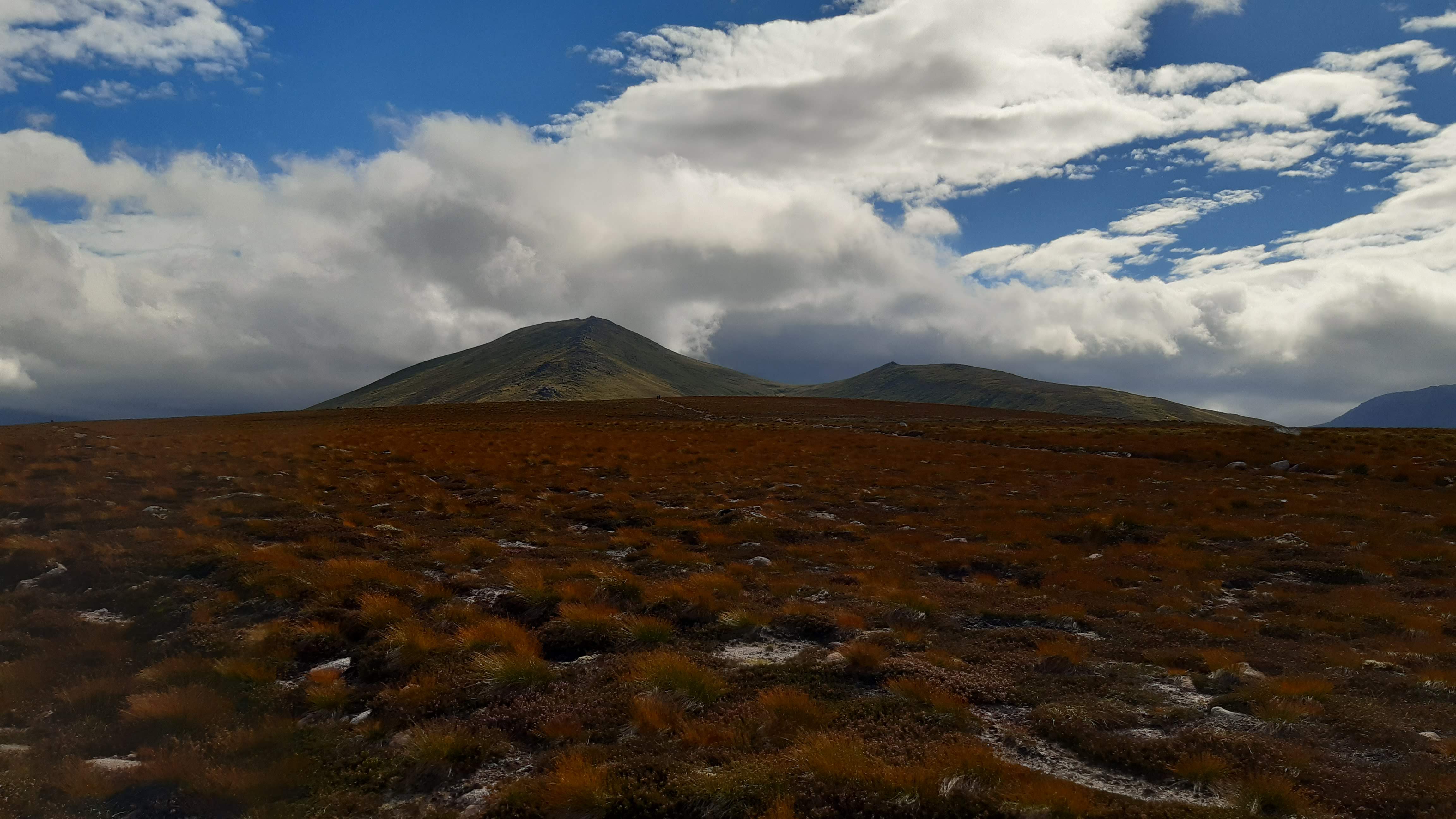
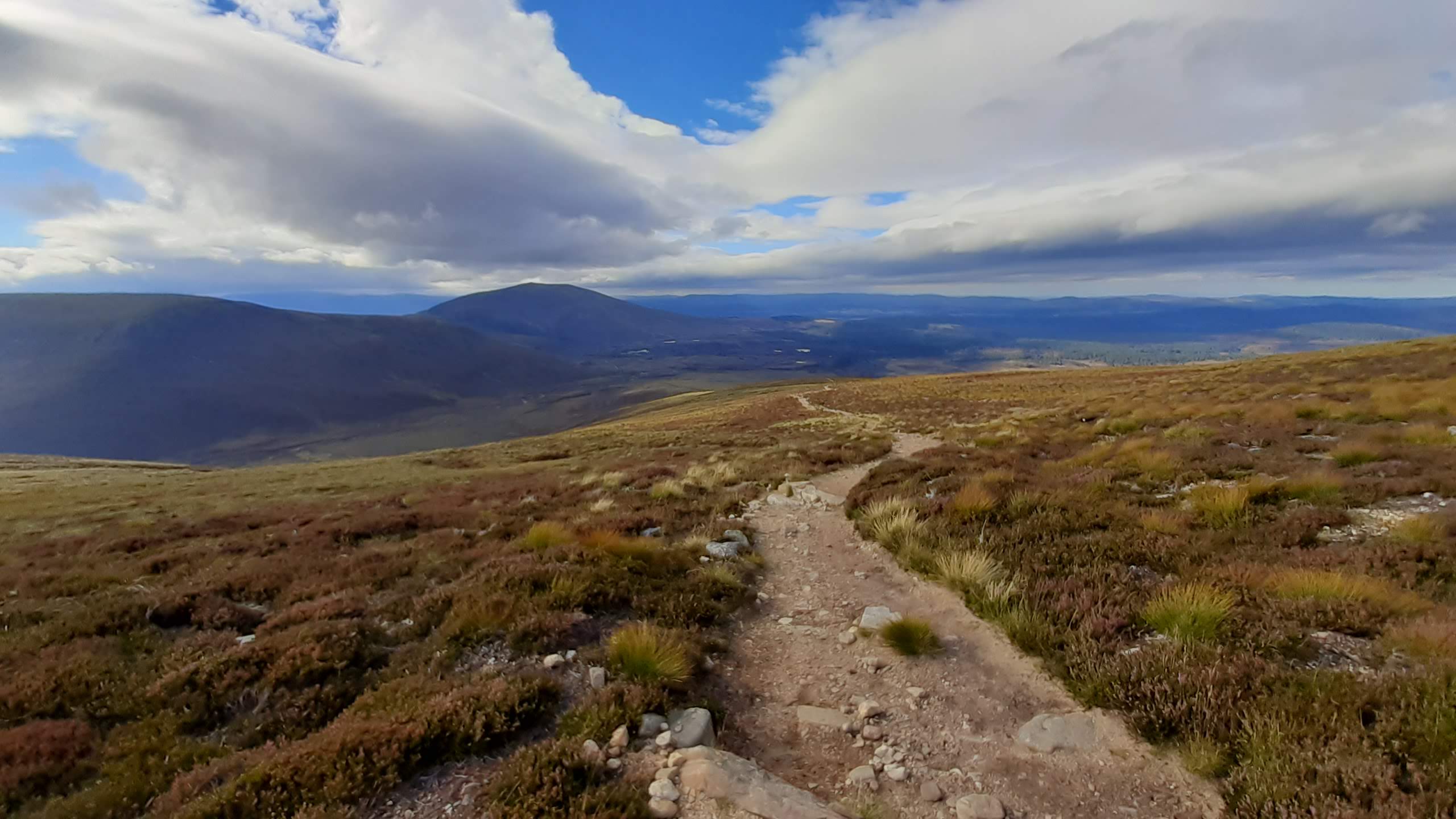
Day 9 – 12 – Cape Wrath to Cairngorms National Park (170 miles 10000ft elev)
As I had a few more days of holiday left, I decided to cycle over to Inverness then take the train to Aviemore. I was going back and forth where in Scotland I wanted to go or if I should road cycle back to Glasgow from Cape Wrath, but was recommended to check out the Cairngorms as I neared Inverness by a couple cycle tourers. I was not let down.
The Cairngorms reminded me of California with the strong smell of pine wherever you went. I very much enjoyed it, but accidentally ended up doing some massive hike a bike section on the inner loop of the Cairngorms bikepacking route as I hadn’t researched the route before cutting out a piece of it for my few days out. I’m not entirely sure why someone would want to carry their bike over a mountain range for miles and miles considering the outer loop of the Cairngorms is very rideable, but hey, that’s what happens sometimes. Feeling tired and in need of some rest I caught the train from Kingussie to Glasgow on my last day then onto London.
It was a wonderful trip with loads of great memories. The An Turas Mor route was a perfect route for someone like me that doesn’t feel comfortable on very technical sections, but enjoys long days of riding. If you’ve made it this far, thanks for taking the time to read my story.


What an adventure!
LikeLike
Makes me “homesick” for Scotland. Thank you for the very descriptive and enjoyable read.
LikeLike
Glad you liked it meem. We will have to go back sometime.
LikeLike
Hi nick,
Mick here, we cycled for a bit of the cairngorm loop, great blog. I’m sorry you found the inner loop disappointing. I stuck with the outer as I’d heard the inner was a lot of hike bike. Oh well. The Outer is a great route, highly recommended. Bit of hike bike in places, especially upper Glen tilt but otherwise a fine route. Really enjoyed the blog.
Mick
LikeLike
Thank you Mick! Was great meeting you along the way and cheers for the good company. I half thought I’d find you somewhere on the middle loop as I thought we were mostly on the same track. I’ll have to head back to the Cairngorms to get that outer loop in sometime. Really enjoyed looking through your pictures on fb.
LikeLike
awesome! great writing and great photos. thank you for informing us about the route and sharing your experience
LikeLike
Thanks a lot Evan. I’m glad you enjoyed it!
LikeLike
Great blog and amazing photos. I almost felt like I was there too. Hungry now for a Scottish breakfast!
LikeLike
A good read, Nick. Sounds like you found a good challenge but with plenty of time to smell the roses – or heather.
LikeLike
Great write up, hope to do this route next year 2021 on the fat bike (Surly Pugsley) 😀
LikeLiked by 1 person
Thank you! You’ll love it. Perfect bike for it. Just avoid the midgie season if you can 😉
LikeLike